Rivière-à-la-Lime facts for kids
Quick facts for kids Rivière à la lime |
|
|---|---|
|
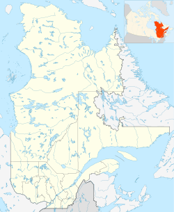
"Rivière-à-la-Lime", in Sainte-Geneviève-de-Batiscan in Batiscanie, in Quebec
|
|
| Physical characteristics | |
| Main source | Saint-Narcisse, Quebec 109 m (358 ft) 46°32′07″N 72°22′29″W / 46.53528°N 72.37472°W |
| River mouth | Batiscan River, at Sainte-Geneviève-de-Batiscan 10 m (33 ft) |
| Length | 12.14 km (7.54 mi) |
| Basin features | |
| Basin size | 25.86 km2 (9.98 sq mi) |
| Tributaries |
|
The Rivière à la lime is a river in Quebec, Canada. It flows through the town of Sainte-Geneviève-de-Batiscan. This river is about 12.14 kilometers (7.5 miles) long. It drains an area of 25.86 square kilometers (10 square miles) before it flows into the Batiscan River.
Where is the Rivière à la lime?
The Rivière à la lime starts in a hilly area called the Saint-Narcisse moraine. It then flows east through farms and small forests. This area is a flat plain at the bottom of a large hill range. This range runs parallel to the Saint Lawrence River.
The river gets water from Bradley Creek, which joins it about 3.6 kilometers (2.2 miles) from its end. Bradley Creek comes from Saint-Luc-de-Vincennes. The Rivière à la lime also flows under Quebec Route 361.
The river finally empties into the Batiscan River. This happens near a place called "la Grande pointe," just above the village of Sainte-Geneviève-de-Batiscan. The mouth of the Rivière à la lime is about 6.2 kilometers (3.8 miles) downstream from the River des Chutes. It is also 9.2 kilometers (5.7 miles) downstream from the Rivière des Envies.
In 1875, a newspaper in Trois-Rivières reported that there were large amounts of bog iron ore near the Rivière à la lime. This is a type of iron found in bogs.
The area around the Rivière à la lime was one of the first places settled in the Lordship of Batiscan. This happened after people settled near the Saint Lawrence River and Batiscan River. Farming is the main activity in the river's watershed (the land area that drains into the river). Most homes in this area are located along certain roads, like the "Third row," "Great Line," and "Rivière-à-la-Lime" road.
What does "Rivière à la lime" mean?
There are three main ideas about how the Rivière à la lime got its name:
- Wiggly River: Some think the river's winding path looks like the teeth of a saw or a file (a tool used for shaping things).
- Muddy Water: Another idea is that the river's water is often silty or muddy. This could be from peat, clay, or other soil.
- Lime (Chaux): The word "lime" in French can mean "chaux." This is a white, powdery substance that easily absorbs water. It's made by heating limestone. In the past, lime was used a lot in building things, like foundations for roads and buildings. It was also used to whiten the outside and inside of farm buildings.
The official name "Rivière à la lime" was recorded on December 5, 1968, by Quebec's Geographical Board of Names. The road called "rang Rivière-à-la-Lime" was officially named on April 9, 1979. This road's name comes from the river itself.
History of the River Area
- Sawmill: In the early 1800s, a man named J.B. Baril built a sawmill on the Rivière à la lime. This mill was on lot 582, which belonged to Joseph Drapeau. J.B. Baril may have run the mill himself. Later, in 1873, Antoine Désaulniers bought the mill. He sold it in 1884, after the mill had stopped working. A shoemaker, storyteller, and singer named Theophile Bronsard lived there in the late 1800s.
- Iron Forges: The St. Genevieve forges, which were places where metal was heated and shaped, operated on the Rivière à la lime from 1794 to 1813.
- Pioneer Trails: Early settlers who moved to what is now Saint-Narcisse came from Sainte-Geneviève-de-Batiscan. They followed the path of the Rivière à la lime and other forest trails to reach their new land. From there, they could walk through the forest to an area called "Rivière des Envies," which is now Saint-Stanislas. By walking along the western shore, these pioneers could get around the "Great falls" of the Batiscan River.


