Rivière des Chutes (Batiscan River tributary) facts for kids
Quick facts for kids Rivière des Chutes |
|
|---|---|
|
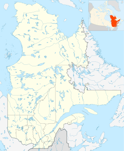
"Rivière des Chutes", in Saint-Narcisse and Saint-Stanislas, in Batiscanie, in Quebec
|
|
| Native name | Rivière des Chutes |
| Country | Canada |
| Physical characteristics | |
| Main source | Lac Noir (Black Lake) (at the limit of Hérouxville and Saint-Narcisse) |
| River mouth | Saint-Stanislas (Les Chenaux), province (Quebec), Canada 46°31′48″N 72°22′29″W / 46.53°N 72.37472°W |
| Length | 20.4 km (12.7 mi) |
| Basin features | |
| River system | St. Lawrence River |
| Basin size | 76.1 km2 (29.4 sq mi) |
The Rivière des Chutes, which means River of the Falls in English, is a river in Quebec, Canada. It mainly flows through the town of Saint-Narcisse. At the end of its journey, it also passes through Saint-Stanislas. These towns are part of the Les Chenaux Regional County Municipality in the Mauricie region.
The Rivière des Chutes is about 20.4 kilometres (12.7 mi) (12.7 miles) long. This includes 1.7 km (1.1 miles) that flow through Saint-Stanislas near its end. The river drains a large area of land, covering about 76.1 square kilometres (29.4 sq mi) (29.4 sq mi). This area is called its watershed.
Contents
River's Journey
Where the River Starts
The Rivière des Chutes begins in a place called "Lac Noir," or Black Lake. Some people also call it "Morin Lake." This lake is located near the towns of Hérouxville and Saint-Narcisse.
Long ago, the water from Black Lake flowed into another lake called Ataca Lake. But over time, the Black Lake got smaller. Now, its water flows south and becomes the start of the Rivière des Chutes.
Flowing Through the Land
The river starts in a wet area and flows mostly southeast. It follows a path that sometimes twists and turns. The river crosses a road called "Grande Ligne" (Great Line) many times. To help people get around, a part of the road was built to go around the river's path.
First Row of the Falls
Next, the river turns south and flows into an area known as the "Premier rang des chutes," which means "First row of the Falls." Here, it crosses many pieces of land. The river also gets water from smaller streams that flow into it from the surrounding areas.
Eventually, the river turns east. It crosses the "Grande Ligne" road again and flows back into the Lordship of Batiscan area.
Around the Village
The river then goes around the village of Saint-Narcisse from the northeast side. In the past, there was a sawmill and a flourmill here, powered by the river's water. As the river flows east towards Saint-Stanislas, two roads follow its path: the North Falls row and the South Falls row.
South of Route 352
The river crosses Route 352. Then, it turns east again, flowing next to Route 352. Finally, the river enters Saint-Stanislas. It flows through several more areas before reaching its end. The part of the river south of Route 352 runs alongside a natural ridge called the Saint-Narcisse moraine.
Where the River Ends
The Rivière des Chutes mostly flows through farmland. It makes many small curves and passes through some wooded areas, especially at its beginning and end.
The river empties into the Batiscan River. This spot is special because it's right at the bottom of the "Chutes des Ailes" (Falls to the Wings). There are also islands nearby called "Iles des Ailes" (Islands in the Wings). The mouth of the Rivière des Chutes is located about 1.7 km (1.1 miles) upstream from the dam in Saint-Narcisse.
Sanschagrin Stream
The most important stream that flows into the Rivière des Chutes is called Sanschagrin stream. This stream flows south through Saint-Stanislas for about 3.3 km (2.1 miles). It drains an area of 9.4 km² (3.6 sq mi).
The Sanschagrin stream joins the Rivière des Chutes just south of Route 352. It's about 0.7 km (0.4 miles) west of where the Rivière des Chutes meets the Batiscan River.
In Saint-Narcisse, the Rivière des Chutes used to be a challenge for early settlers trying to travel. Except when the river was frozen, people had to take a longer route. They would use a bridge over the Rivière des Chutes and then follow a road to get to other parts of the municipality.
River's History
Early Settlements
People started to settle near the Rivière des Chutes in the late 1700s. Pioneers, or early settlers, moved north into this area. They were looking for new land because there wasn't much available left closer to the Saint Lawrence River.
Mills on the River
A sawmill, owned by Albert Cossette, was built on the North of the Falls River. This mill used the power of the river's water to operate. The water was held back by a dam, which helped power the mill. There was also a flour mill located behind the sawmill.
Why the Name "River of the Falls"?
The name "Rivière des Chutes" (River of the Falls) comes from the fact that the river flows into the Batiscan River right at the base of the "Chutes de l'Aile" (Fall of the Wings). This area has several waterfalls nearby, including "Chute à Jimmy" (Jimmy Falls) and "Chute à Murphy" (Murphy Falls).
Naming the river "River of the Falls" helped people traveling on the Batiscan River know where they were. In this area, people traveling by canoe often had to carry their canoes and supplies around the waterfalls.
The name "Rivière des Chutes" became official on December 5, 1968. It was added to the list of place names by the Commission de toponymie du Québec, which is Quebec's geographical names board.
 | Kyle Baker |
 | Joseph Yoakum |
 | Laura Wheeler Waring |
 | Henry Ossawa Tanner |


