Rivière à la Truite (Chaudière River tributary) facts for kids
Quick facts for kids Rivière à la Truite |
|
|---|---|

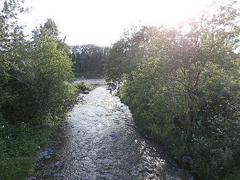
Rivière à la Truite at its confluence with the Chaudière River.
|
|
| Country | Canada |
| Province | Quebec |
| Region | Chaudière-Appalaches |
| MRC | Beauce-Sartigan Regional County Municipality |
| Physical characteristics | |
| Main source | Agricultural streams Saint-René 407 metres (1,335 ft) 45°57′29″N 70°33′22″W / 45.958151°N 70.556152°W |
| River mouth | Chaudière River Saint-Martin 235 metres (771 ft) 45°54′02″N 70°38′03″W / 45.90055°N 70.63416°W |
| Length | 12.0 kilometres (7.5 mi) |
| Basin features | |
| Progression | Chaudière River, St. Lawrence River |
| River system | St. Lawrence River |
| Basin size | 47.9 kilometres (29.76 mi) |
| Tributaries |
|
The Rivière à la Truite is a river in Quebec, Canada. Its name means "Trout River" in English. This river is a smaller stream that flows into a larger river called the Chaudière River. The Chaudière River then flows north and eventually joins the mighty St. Lawrence River.
Contents
Where is the Rivière à la Truite?
This river is located in the Chaudière-Appalaches region of Quebec. It flows through the area known as the Beauce-Sartigan Regional County Municipality.
How Long is the River?
The Rivière à la Truite is about 12 kilometers (about 7.5 miles) long. That's like walking from one end of a small town to the other!
Where Does It Start and End?
The river begins high up in the land, about 407 meters (1,335 feet) above sea level. It starts from small streams in farming areas near a place called Saint-René.
From there, it flows downhill and eventually meets the Chaudière River. This meeting point is in a town called Saint-Martin. At this spot, the river is much lower, about 235 meters (771 feet) above sea level.
Why is it Called "Trout River"?
The name "Rivière à la Truite" was officially given to this river on December 5, 1968. This was done by the Commission de toponymie du Québec, which is a group in Quebec that names places. The name likely comes from the type of fish, trout, that might have been found in the river.
The River's Journey
The Rivière à la Truite is a "tributary" of the Chaudière River. A tributary is a smaller river or stream that flows into a larger river. So, the water from the Rivière à la Truite joins the Chaudière River.
The Chaudière River then continues its journey north. It eventually empties into the huge St. Lawrence River, which is one of the biggest rivers in North America. This means the water from the small Rivière à la Truite eventually makes its way to the Atlantic Ocean!
What is a River Basin?
The area that collects all the water for a river is called its "basin" or "watershed." The Rivière à la Truite has a basin size of about 47.9 square kilometers (about 18.5 square miles). This area includes all the land where rain and snow melt will eventually flow into the river.
Other Streams Joining the River
Just like the Rivière à la Truite flows into a bigger river, it also has smaller streams that flow into it.
- On its left side (if you're looking downstream), it gets water from the Petite rivière à la Truite (Little Trout River) and a stream called Ruisseau Fortier.
- On its right side, it gets water from Ruisseau Jos-Cliche and Ruisseau Blais.


