
Rivière des Fermes facts for kids
Quick facts for kids Rivière des Fermes |
|
|---|---|

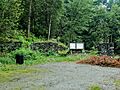
Rivière des Fermes seen from Rang des Érables.
|
|

|
|
| Country | Canada |
| Province | Quebec |
| Administrative region | Chaudière-Appalaches |
| RCM | Robert-Cliche Regional County Municipality, La Nouvelle-Beauce Regional County Municipality |
| Physical characteristics | |
| Main source | Moutain and forested streams Saint-Frédéric 309 metres (1,014 ft) 46°15′17″N 71°00′42″W / 46.254815°N 71.011731°W |
| River mouth | Chaudière River Saint-Joseph-des-Érables 140 metres (460 ft) 46°18′46″N 70°53′28″W / 46.31278°N 70.89111°W |
| Length | 18.8 kilometres (11.7 mi) |
| Basin features | |
| Progression | Chaudière River, St. Lawrence |
| Tributaries |
|
The Rivière des Fermes is a river in Quebec, Canada. It flows into the Chaudière River from its west side. The Chaudière River then flows north to join the mighty St. Lawrence River.
This river is located in the Chaudière-Appalaches region of Quebec. It passes through the areas of Saint-Frédéric, Tring-Jonction, and Saint-Joseph-des-Érables.
Where the River Flows
The Rivière des Fermes starts in a hilly, forested area. Its source is in the Broughton township. This spot is between the towns of Saint-Séverin and Saint-Frédéric.
The river flows for about 18.8 kilometers (about 11.7 miles). It starts by flowing southeast through Saint-Frédéric. Then it crosses the village of Tring-Jonction. Along its journey, it meets smaller streams that join it.
The river then turns east and northeast. It crosses Quebec Route 276 twice. There's even a small waterfall called the "Louisette waterfall" along its path. Finally, the Rivière des Fermes empties into the Chaudière River. This meeting point is in Saint-Joseph-des-Érables.
Why it's Called "Fermes River"
The name "Rivière des Fermes" (which means "River of the Farms" in English) has a cool history. Close to where the river joins the Chaudière River, there used to be a lot of rapids. A long time ago, a mill was built there. This mill was set up by Lord Joseph de Fleury de La Gorgendière.
The area around the mill was known as the "Grandes Fermes," meaning "Big Farms." This was the lord's own land. A farm road led up the hill to the mill and its waterfall. The old mill was taken down in 1962. Later, a campground was built in its place.
People have used the name "Rivière des Fermes" in documents since the late 1700s. It has appeared on maps since at least 1878. The name "rivière des Fermes" was officially recognized on December 5, 1968. This was done by the Commission de toponymie du Québec, which names places in Quebec.
Images for kids
-
Site of the old seigneurial mill.

