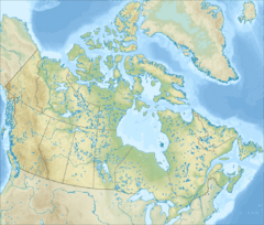
Rivière des Grands Méchins Ouest facts for kids
Quick facts for kids Rivière des Grands Méchins Ouest |
|
|---|---|
| Country | Canada |
| Province | Quebec |
| Administrative region (QC) | Bas-Saint-Laurent (QC) |
| MRC (QC) | La Matanie Regional County Municipality (QC) |
| City | Cap-Chat |
| Physical characteristics | |
| Main source | Small lake Saint-Jean-de-Cherbourg 435 units? 48°54′29″N 66°58′39″W / 48.90806°N 66.97750°W |
| River mouth | Saint Lawrence River Les Méchins (Dalibaire (township)) 35 metres (115 ft) 48°58′36″N 66°57′13″W / 48.97667°N 66.95361°W |
| Length | 9.9 mi (15.9 km) |
The Rivière des Grands Méchins Ouest is a river in Quebec, Canada. It's like a smaller stream that flows into a bigger river. This river joins the Rivière des Grands Méchins on its west side.
Eventually, the water from these rivers flows north into the mighty Saint Lawrence River. This happens near the town of Les Méchins. The river travels through the beautiful Chic-Choc Mountains. It is part of the La Matanie Regional County Municipality area.
Where the River Starts and Ends
This river begins in the Chic-Choc Mountains. It starts from a small lake high up, about 435 meters (1,427 feet) above sea level. It also gets water from mountain streams. This starting point is in a part of Quebec called the Gaspé peninsula.
The river's source is about 9.9 kilometers (6.15 miles) southeast of the Gulf of Saint Lawrence. It's also not far from Gaspésie National Park.
The River's Journey
The Rivière des Grands Méchins Ouest flows for about 9.9 kilometers (6.15 miles). It travels mostly towards the northeast.
- For the first 3.9 kilometers (2.4 miles), it flows northeast. It picks up water from a small stream along the way.
- Then, for about 1.1 kilometers (0.68 miles), it goes through a deep valley. Another stream joins it from the west.
- Finally, it flows for another 4.9 kilometers (3 miles) through a deep valley. This is where it meets the main Rivière des Grands Méchins.
The river flows into the main Grands Méchins river on its west side. This meeting point is about 3 kilometers (1.86 miles) south of Quebec Route 132.
What's in a Name?
The word "Méchin" is a family name that comes from France. The name Rivière des Grands Méchins Ouest was officially recognized on December 5, 1968. This was done by the Commission de toponymie du Québec, which is like a group that names places in Quebec.
 | Toni Morrison |
 | Barack Obama |
 | Martin Luther King Jr. |
 | Ralph Bunche |


