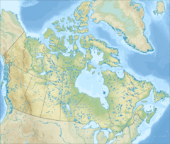
Rivière des Grands Méchins facts for kids
Quick facts for kids Rivière des Grands Méchins |
|
|---|---|
| Country | Canada |
| Province | Quebec |
| Administrative region (QC) | Bas-Saint-Laurent (QC) |
| MRC (QC) | La Matanie Regional County Municipality (QC) |
| City | Cap-Chat |
| Physical characteristics | |
| Main source | Lacs des Petits Chic-Chocs Saint-Jean-de-Cherbourg 569 units? 48°53′15″N 66°59′42″W / 48.88750°N 66.99500°W |
| River mouth | Saint Lawrence River Les Méchins 0 metres (0 ft) 49°00′11″N 66°58′12″W / 49.00306°N 66.97000°W |
| Length | 22.8 mi (36.7 km) |
| Basin features | |
| Tributaries |
|
The Rivière des Grands Méchins is a river in Quebec, Canada. It flows into the big St. Lawrence River on its south side. This river is located in the area of Les Méchins. It flows north through the beautiful Chic-Choc Mountains. The river is part of the La Matanie Regional County Municipality (MRC) in the Bas-Saint-Laurent region.
Contents
Where the River Starts and Ends
The Grands Méchins river begins in a small lake high up in the mountains. This lake is about 495 meters (1,624 feet) above sea level. It's found among the Petits Chic-Chocs lakes and mountain streams. This area is in the eastern part of the Chic-Choc Mountains.
The river's source is about 11 kilometers (6.8 miles) southeast of the Gulf of St. Lawrence coast. It's also close to the edge of Parc national de la Gaspésie.
The River's Journey
From its start, the Grands Méchins river travels about 22.8 kilometers (14.2 miles). Here's how it flows:
- It flows east for about 2.6 kilometers (1.6 miles).
- Then, it turns northeast and flows for about 9.5 kilometers (5.9 miles) through a deep valley.
- Next, it goes northwest for about 6.5 kilometers (4.0 miles), still in a deep valley. Here, another river, the rivière des Grands Méchins Ouest, joins it.
- Finally, it flows north for about 4.2 kilometers (2.6 miles). It passes through the village of Méchins and under the Route 132 bridge.
Where the River Meets the Sea
The Grands Méchins river empties into the Méchins cove. This is a part of the huge estuary of Saint Lawrence. At low tide, the beach here can stretch out for up to 0.2 kilometers (0.12 miles).
This meeting point is about 23 kilometers (14.3 miles) southwest of Cap-Chat. The Méchins cove itself is about 3 kilometers (1.9 miles) long. It lies between two capes: Cap Le Gros Machins to the west and Cap des Méchins to the east. A mountain called Ilets Mountain stands tall to the east of Méchins village, looking over the cove.
What's in a Name?
The name Méchin is actually a family name that comes from France.
The official name "Rivière des Grands Méchins" was made formal on December 5, 1968. This was done by the Commission de toponymie du Québec, which is the group in charge of place names in Quebec.
 | Misty Copeland |
 | Raven Wilkinson |
 | Debra Austin |
 | Aesha Ash |


