
Rivière-Rouge facts for kids
Quick facts for kids
Rivière-Rouge
|
|
|---|---|
|
City
|
|
 |
|

Location within Antoine-Labelle RCM
|
|

Rivière-Rouge
Location in Central Quebec
|
|
| Country | |
| Province | |
| Region | Laurentides |
| RCM | Antoine-Labelle |
| Constituted | December 18, 2002 |
| Area | |
| • City | 498.40 km2 (192.43 sq mi) |
| • Land | 455.35 km2 (175.81 sq mi) |
| • Water | 50 km2 (20 sq mi) |
| • Urban | 6.4 km2 (2.5 sq mi) |
| Population
(2011)
|
|
| • City | 4,645 |
| • Density | 10.2/km2 (26/sq mi) |
| • Pop 2006-2011 | |
| • Dwellings | 2,960 |
| Time zone | UTC−5 (EST) |
| • Summer (DST) | UTC−4 (EDT) |
| Postal code(s) |
J0T 1T0 & J0T 2X0
|
| Area code(s) | 819 |
| Highways | |
Rivière-Rouge (English translation: Red River) is a city located in the Antoine-Labelle Regional County Municipality, Quebec, Canada. The population as of the Canada 2011 Census was 4,645.
Contents
History
As part of the 2000–2006 municipal reorganization in Quebec, the city was created on December 18, 2002 by the amalgamation of the villages of L'Annonciation, La Macaza, Sainte-Véronique, and Canton Marchand. After a referendum in 2004, La Macaza regained its independent status on January 1, 2006 but remains part of the Urban agglomeration of Rivière-Rouge. The urban agglomeration is responsible for managing aspects that are common to all municipalities that were once merged, examples are 911 service, public safety, recycling and many other city functions that were merged into the city. The original villages are now the sectors of L'Annonciation, Marchand, and Sainte-Veronique. Although the city is named Rivière-Rouge, most people still call each town by its historical name.
The city is named for Rouge River that runs through the area. It is a tributary of the Ottawa River (French: Rivière des Outaouais). The region was always known as La Vallee de la Rouge (English: The Valley of the Red), and the city name was probably chosen for this reason. The now defunct local Air cadet squadron number 883 was also called Rivière-Rouge.
The village of l'Annonciation was created in 1908 from the "Downtown" area of the municipality of Marchand, so in one sense it has been re-absorbed into the whole. The two municipalities had done many things in cooperation prior to the merger.
Development
The provincial government has over the years looked into creating a bypass of the Trans-Canada Highway Route 117 that runs through the L'Annonciation sector, in order to alleviate traffic problems caused by a combination of heavy truck traffic, heavy weekend tourist traffic and a main street that was not built for the amount of traffic. The currently planned new route would cut traffic in the downtown L'Annonciation area by an estimated 75%. The road would split off the current highway south of the village and pass the village to the west, and rejoin the main road just to the north near highway 321. There would also be one additional exchange built off the new highway, about half way that would join up to Montée Marois, a street in the center of the village where the only traffic light is. Much of the land acquisition surveying, and clearing has been undertaken over the past two years. It was expected to be completed by the end of 2009, as of 2011 is still under construction.
Images for kids
-
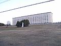
Centre Hospitalier Des Laurentides
-
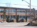
Du Méandre School


See also
 In Spanish: Rivière-Rouge para niños
