
Road Town facts for kids
Quick facts for kids
Road Town
|
|
|---|---|
|
Town
|
|

Road Town, Tortola
|
|

Map showing Road Town within the BVI
|
|
| Country | |
| British Overseas Territory | |
| Island | Tortola |
| Elevation | 10 m (30 ft) |
| Population
(2012)
|
|
| • Total | 12,603 |
| Postal Code |
VG1110
|
Road Town, located on the island of Tortola, is the capital and largest town of the British Virgin Islands. It sits on the horseshoe-shaped Road Harbour in the middle of the island's south coast. In 2018, about 15,000 people lived there.
The name "Road Town" comes from a sailing term, "the roads". This means a place where ships can anchor easily, even if it's not as protected as a full harbour. A large area called Wickham's Cay was created by adding land to the sea. This area, which includes a marina, has made Road Town a popular spot for renting yachts and a major tourist hub. This newer part of the city is now home to many new businesses and government buildings. The oldest building in Road Town is HM Prison on Main Street, built in 1774.
Contents
Weather in Road Town
The British Virgin Islands have a warm, tropical climate. Gentle trade winds help keep the temperatures comfortable all year. In Road Town, the capital, summer temperatures usually reach around 32 °C (89.6 °F). In winter, they are about 29 °C (84.2 °F). Nighttime temperatures are around 24 °C (75.2 °F) in summer and 21 °C (69.8 °F) in winter.
Road Town gets about 1,150 mm (45.3 in) of rain each year. More rain falls in the hills, and less near the coast. The amount of rain can change a lot from year to year. The wettest months are usually September to November. The driest months are typically February and March. Sometimes, strong storms called hurricanes hit the islands. The hurricane season runs from June to November.
| Climate data for Virgin Gorda, British Virgin Islands | |||||||||||||
|---|---|---|---|---|---|---|---|---|---|---|---|---|---|
| Month | Jan | Feb | Mar | Apr | May | Jun | Jul | Aug | Sep | Oct | Nov | Dec | Year |
| Record high °C (°F) | 33 (91) |
32 (89) |
32 (89) |
35 (95) |
34 (93) |
35 (95) |
35 (95) |
36 (96) |
35 (95) |
33 (92) |
33 (91) |
31 (87) |
36 (96) |
| Mean daily maximum °C (°F) | 26 (79) |
27 (80) |
28 (82) |
29 (84) |
29 (85) |
30 (86) |
31 (87) |
31 (87) |
30 (86) |
29 (85) |
28 (82) |
27 (80) |
29 (84) |
| Mean daily minimum °C (°F) | 20 (68) |
19 (67) |
20 (68) |
21 (69) |
22 (71) |
23 (73) |
23 (73) |
23 (73) |
23 (73) |
22 (72) |
22 (71) |
21 (69) |
22 (71) |
| Record low °C (°F) | 17 (62) |
16 (60) |
16 (60) |
17 (62) |
18 (64) |
18 (65) |
19 (66) |
19 (66) |
16 (61) |
18 (64) |
17 (63) |
16 (60) |
16 (60) |
| Average rainfall mm (inches) | 74 (2.92) |
63 (2.49) |
55 (2.18) |
85 (3.33) |
117 (4.59) |
71 (2.78) |
83 (3.27) |
110 (4.4) |
156 (6.14) |
133 (5.25) |
179 (7.04) |
110 (4.4) |
1,236 (48.79) |
| Source: Intellicast | |||||||||||||
Getting Around Road Town
Road Town is a main spot for bareboating in the Caribbean. Bareboating means renting a yacht without a crew to sail it yourself. Many successful yacht rental companies operate from Road Town. You can often see large cruise ships docked here too.
The harbour is a popular starting point for many ferries that travel between the islands. The ferry terminal is on the northwest side of Road Town. Ferries run during the day every day, but rarely at night. It's a good idea to check the ferry schedule before you travel.
Road Town is close to the British Virgin Islands' only major airport. This is Terrance B. Lettsome International Airport (EIS) on Beef Island. Only short flights are available from this airport. For longer flights, people use Cyril E. King Airport in the nearby US Virgin Islands (STT).
When people talk about "buses" in Tortola, they mean large passenger vans. They can also be big, open-air pickup trucks with benches and a canvas roof, known as "safaris." Taking a bus is often cheaper than a private taxi. It's a common way to get from the airport to Road Town, or from town to other parts of the island.
Road Town's History
On August 1, 1834, the Slavery Abolition Act was officially announced at a place called Sunday Morning Well. This act made slavery illegal.
In 1853, a big fire destroyed almost every building in Road Town. The fire started because people were upset about a new tax on cattle. These upset people eventually set fire to many farms across the island.
On September 4, 2017, Hurricane Irma hit the British Virgin Islands. It was the strongest tropical storm to ever hit the islands. The hurricane caused a lot of damage and sadly, some people lost their lives.
Where is Road Town?
It can be a bit confusing to know exactly where Road Town begins and ends. If you come from the west, a sign at the bottom of Slaney Hill welcomes you to Road Town. However, some people believe the town truly starts closer to Road Reef and Fort Burt. They think Prospect Reef Hotel, which is between these points, is not technically part of Road Town.
Coming from the east, it's also unclear if Road Town starts at the Port Purcell roundabout below Fort George, or if it includes the area called Baughers' Bay.
Historically, Fort Burt and Fort George marked the western and eastern edges of the town. These forts helped protect the town.
Images for kids
-
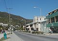
The Waterfront Drive in Road Town, Tortola
-
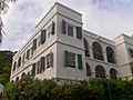
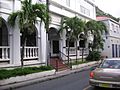
The Old Government House
-
Main Street
-

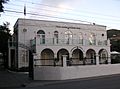
Harney Westwood & Riegels building
-
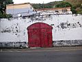
The old HM Prison
-
The House of Assembly Building
-
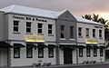
The old Post Office
-
Conyers Dill & Pearman and Colombian Emeralds stores
-

bmobile's headquarters in the BVI
-
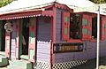
A shop on Main Street
-

Safari buses used for transport
-

A passenger ferry arriving at Road Town Ferry Terminal


See also
 In Spanish: Road Town para niños
