Robert Aitken's new Parish Atlas of Ayrshire. 1829. facts for kids
Quick facts for kids
Robert Aitken
|
|
|---|---|
Robert Aitken, Cartographer
|
|
| Born | Circa 1786 |
| Occupation | Land Surveyor & Cartographer |
Robert Aitken was a Land Surveyor and a Cartographer (mapmaker) born around 1786 in Ayrshire, Scotland. In 1829, he created and published a special book of maps called "A new Parish Atlas of Ayrshire, Part 1, Cuninghame District" in Beith, North Ayrshire. This atlas was a big project that helped people understand the geography of the area.
Contents
Robert Aitken: Mapmaker Extraordinaire
Robert Aitken wanted to create a detailed map book of Ayrshire. He wrote a "proposal" to find people who would pay in advance to get a copy. This proposal explained what the atlas would include. It said that "Each map will contain the names of every House within the Parish - the whole Roads, Turnpike, Parochial, and Private - and the Rivers and Streams.". It also promised to show "the names of the principal Heritors" (main landowners) and "sundry Statistical and Historical Notices" (interesting facts and history).
Aitken hoped to get 100 people to sign up, and he managed to get 86! Many of these supporters were important landowners and even members of the aristocracy in Ayrshire. This showed that he had good connections and that his work was highly valued.
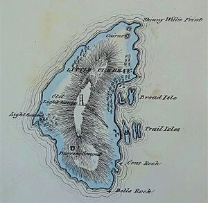
In 1829, he began publishing his atlas in Beith. It included maps of all 16 parishes in the Cuninghame area. The maps were drawn at a scale of 2 inches for every 1 mile. Aitken dedicated his atlas to Archibald William Montgomerie, 13th Earl of Eglinton, an important local figure. The atlas also had a detailed table showing distances between towns in the county.
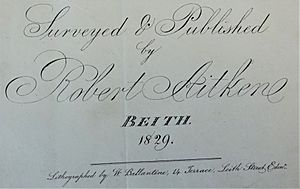
The atlas was a large book with 14 maps. Robert Aitken surveyed the land himself, and W. Ballantine from Edinburgh was the lithographer, meaning he printed the maps. We don't know exactly how many copies were printed, but we know there were 86 subscribers.
Rare Maps and Special Copies
These maps are quite rare today. In 2016, one atlas was sold at an auction for £550. When it was first offered, people who paid in advance for the whole atlas paid 2 shillings and 6 pence per map sheet. If they only wanted maps of certain parishes, it cost 5 shillings per sheet.
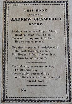
One copy of the atlas has a unique bookplate (a special label inside a book) belonging to Andrew Crawford. He was also a land surveyor from Dalry and a respected person in his community. He was even the chairman of the Dalry Burns club for many years. Interestingly, he wasn't listed as one of the original subscribers.
Robert Aitken also created other maps, like a plan of Cowieland for John Richmond in 1837. Cowieland was a place near Beith.
Aitken's map of the Parish of Beith was very well received. People with "Scientific knowledge and taste" praised it. This encouraged him to map other parishes in Cuninghame. He had plans to survey other parts of Ayrshire, like Kyle and Carrick, but these plans never happened. This might have been because another cartographer, John Thomson, published his own large map of "Northern Part of Ayrshire" in 1828.
What Information Was on the Maps?
Robert Aitken promised his subscribers that his maps would be full of useful information. They included:
- The names of every house in the parishes.
- All types of roads: main roads (Turnpike), local roads (Parochial), and private roads.
- Names of rivers and streams.
- Names of the main landowners (Heritors).
- "Sundry Statistical and Historical Notices" – this meant extra facts and historical notes.
These extra facts often included:
- The population of the parishes in different years (1755, 1791, 1801, 1811, 1821).
- The total value of the land in the parish.
- The size of the parish in square miles.
- Sometimes, the exact location (latitude and longitude) of major towns.
- The length of roads and where toll houses were located.
- A color key to explain different types of roads.
- A scale in miles and furlongs at the bottom of the page.
- The areas of moorland (open, uncultivated land) and green pasture (grassland).
- The height of important hills and some significant buildings.
- Markings for ruins and even ancient burial mounds called tumuli.
- The old name for Kilbirnie Loch, which was 'Loch Thankart'.
- Sometimes, the number of lint, corn, and wool mills in a parish.
The maps were carefully colored by hand on special paper. Parish boundaries were highlighted, as were the main roads. Different compass styles showed the north, south, east, and west directions. A table showing distances between places was also included.
Details of the Parish Atlas Maps
Here are some of the maps included in Robert Aitken's atlas:
- Map of Ayrshire (1830)
- Cuninghamia by Timotheo Pont (Engraved 1837)
- Map of Cuninghame (1830)
- Map of the Parishes of Ardrossan, Stevenston and Kilwinning (Surveyed 1828, printed 1829)
- Map of the Parish of Beith (Surveyed 1827, printed 1828)
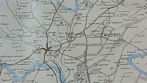
- Map of the Parish of Dalry (Surveyed 1827)
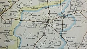
- Map of the Parishes of Irvine, Dreghorn and Kilmaurs (Surveyed & printed 1829)
- Map of the Parishes of Stewarton and Dunlop (Surveyed & printed 1829)
- Map of the Parish of Fenwick (Surveyed & printed 1829)
- Map of the Parish of Kilbirnie (Surveyed 1827; printed 1828)
- Map of the Parish of Kilbride (Surveyed 1827; printed 1829)
- Maps of the Environs of Kilmarnock (Surveyed 1828; printed 1829)
- Maps of the Parish of Largs (Surveyed 1827)
- Map of the Parish of Loudoun (Surveyed & printed 1829)
Robert Aitken's Family Life
According to the 1841 Census, Robert Aitken was a Land Surveyor, about 55 years old. He lived at 35 New Street in Beith with his wife, Mary, who was 50. Mary worked as a "flax throwster," which means she operated a machine that twisted flax fibers into linen yarn. They also had a six-year-old daughter named Elizabeth. The family is not listed in Beith in the 1851 Census, so they may have moved.
We don't know much about his daily life in Beith, but we do know he was a member of the Beith Beneficent Society, a group that helped people in need.
See also
- Lambroughton
 | Madam C. J. Walker |
 | Janet Emerson Bashen |
 | Annie Turnbo Malone |
 | Maggie L. Walker |


