Rockfield, Indiana facts for kids
Quick facts for kids
Rockfield
|
|
|---|---|

Historic District School No. 3
|
|

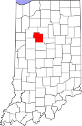
Carroll County's location in Indiana
|
|
| Country | United States |
| State | Indiana |
| County | Carroll |
| Township | Rock Creek |
| Area | |
| • Total | 0.37 sq mi (0.96 km2) |
| • Land | 0.37 sq mi (0.96 km2) |
| • Water | 0.00 sq mi (0.00 km2) |
| Elevation | 699 ft (213 m) |
| Population
(2020)
|
|
| • Total | 211 |
| • Density | 567.20/sq mi (219.26/km2) |
| ZIP code |
46923
|
| GNIS feature ID | 2806556 |
Rockfield is a small, unincorporated community in Carroll County, Indiana. This means it's a group of homes and businesses that isn't officially a town or city. It's located within Rock Creek Township and is part of the Lafayette Metropolitan Statistical Area.
A Look Back in Time
Rockfield was officially planned and laid out in 1856. This process is called "platting." Soon after, in 1857, the Rockfield post office opened.
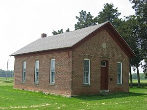
A special building in Rockfield, District School No. 3, is very old and important. It was added to the National Register of Historic Places in 1988. This list includes places that are important to the history of the United States.
Where is Rockfield?
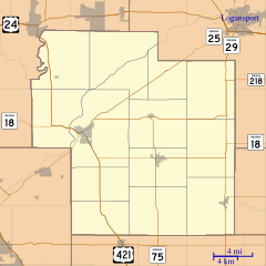
Rockfield is located in an area with lots of farms. It sits south of a stream called Rock Creek. An older part of Indiana State Road 25 and the Norfolk Southern Railway both pass through the northeast side of the community. A newer section of Indiana State Road 25, known as the Hoosier Heartland Highway, goes around the northwest side of Rockfield.
Who Lives in Rockfield?
| Historical population | |||
|---|---|---|---|
| Census | Pop. | %± | |
| 2020 | 211 | — | |
| U.S. Decennial Census | |||
In 2020, the United States Census counted 211 people living in Rockfield. This count helps us understand how many people live in different areas.
 | Kyle Baker |
 | Joseph Yoakum |
 | Laura Wheeler Waring |
 | Henry Ossawa Tanner |


