Rockwood, Virginia facts for kids
Quick facts for kids
Rockwood
|
|
|---|---|

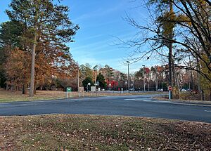
Rockwood Park, located in and named for Rockwood.
|
|
| Country | United States |
| State | Virginia |
| County | Chesterfield |
| Population
(2010)
|
|
| • Total | 8,431 |
| Time zone | UTC−5 (Eastern (EST)) |
| • Summer (DST) | UTC−4 (EDT) |
| ZIP codes |
23236
|
| Area code(s) | 804 |
| FIPS code | 51-68470 |
| GNIS feature ID | 2584911 |
Rockwood is a special kind of place in Chesterfield County, Virginia, called a census-designated place. This means it's an area that looks like a town but isn't officially set up as one with its own local government. In 2010, about 8,431 people lived there.
Contents
Discover Rockwood: A Community in Virginia
Rockwood is a community located in the state of Virginia, in the United States. It's known for its friendly neighborhoods and local parks. Many people enjoy living here because it offers a mix of quiet living and easy access to bigger cities.
Where is Rockwood Located?
Rockwood is found in Chesterfield County, which is in the central part of Virginia. It's not far from the state capital, Richmond. The area is part of the Eastern Time Zone, just like many other places on the East Coast of the U.S.
Geographic Details of Rockwood
The coordinates for Rockwood are 37 degrees, 27 minutes, 46 seconds North and 77 degrees, 34 minutes, 22 seconds West. These numbers help pinpoint its exact location on a map. It's a great way to understand where Rockwood sits in the world.
How Many People Live in Rockwood?
According to the 2010 Census, the population of Rockwood was 8,431 people. This number helps us understand how many residents call Rockwood home. It gives us an idea of the community's size.
Understanding Population Numbers
A "census" is like a big count of all the people living in an area. The United States government does this every ten years. It helps them understand how communities are growing and changing.
What is a Census-Designated Place?
A census-designated place, or CDP, is a special area identified by the U.S. Census Bureau. It's like a community that has a name and a population, but it doesn't have its own city government or mayor. Instead, it's usually part of a larger county.
Why Are CDPs Important?
CDPs help us collect important information about how many people live in certain areas. This data is used for planning things like schools, roads, and other community services. It ensures that even places without official city status are counted.
See also
 In Spanish: Rockwood (Virginia) para niños
 | James Van Der Zee |
 | Alma Thomas |
 | Ellis Wilson |
 | Margaret Taylor-Burroughs |


