Rosedale, New South Wales facts for kids
Quick facts for kids RosedaleNew South Wales |
|||||||||||||||
|---|---|---|---|---|---|---|---|---|---|---|---|---|---|---|---|

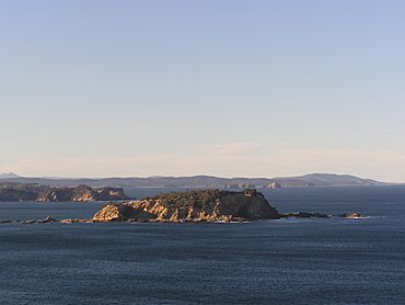
Jimmy's Island offshore from Rosedale, photo taken from Burrewarra Point
|
|||||||||||||||
| Population | 221 (2016 census) | ||||||||||||||
| Postcode(s) | 2536 | ||||||||||||||
| LGA(s) | Eurobodalla Shire | ||||||||||||||
| State electorate(s) | Bega | ||||||||||||||
| Federal Division(s) | Gilmore | ||||||||||||||
|
|||||||||||||||
Rosedale is a lovely beach town located on the south coast of New South Wales, Australia. It's about 18 kilometers south of Batemans Bay by road. This small community is part of the Eurobodalla Shire area. In 2016, about 221 people called Rosedale home. Even though there have been building plans, Rosedale is special because the natural bushland is still more noticeable than the buildings.
Contents
Rosedale's Past
Rosedale has a fascinating history, starting with early farms. Before World War II, there were very few buildings here.
Early Farms and Settlers
In the 1800s, people started clearing the bush in Rosedale to create farms. Two important early settlers were James Sebbens and Karl Thomsen. They worked hard to turn the wild land into places where they could grow food and raise animals.
James Sebbens (the father) was born in England in 1814. He came to Australia in 1838 as a convict and worked in Broulee. Later, he became free and married Celia Ann Barlings. Celia had moved to Australia from England when she was just four years old. The Sebbens family lived near Tomakin and had 14 children!
Joseph Sebbens, James and Cecilia's oldest son, ran a steam mill in Malua Bay in the late 1800s. This mill helped process timber.
James Sebbens (the son), born in 1858, was the one who really developed the Rosedale area. He cleared land for farming, including parts of what is now Burri/Guerilla Bay. His wife's brother, Karl Thomsen, also cleared a lot of land nearby. Even today, you can see the difference in the height and thickness of the trees in areas they cleared, even though some bush has grown back.
From 1870 to 1908, the Sebbens family built a large farm, about 700 acres (280 ha) in size. They mainly raised dairy cows and made cheddar cheese. You can still see some old cow milking sheds near the creek from this time. Their original farmhouse burned down, and the current farmhouse was built using parts of two other houses.
In 1908, the Sebbens family sold their farm to Herman Nibbe and moved to western Sydney to raise chickens.
Rosedale in the 1900s
Herman Nibbe tried to farm sheep and continue making cheese, but he faced money problems. He sold the farm in 1913 but kept farming it until 1921. Horace Benjamin O’Neil bought the farm in 1921. The land was becoming less fertile because the trees had been cleared, making farming harder.
Better transportation, like cars, helped open up the area. The first car in the district was bought in 1908 by Adolf Thomsen, a farmer from Tomakin.
Rosedale Community and Awards
Rosedale has a very active community group called the Rosedale Association, started in the early 1970s. This group has achieved a lot!
For example, Rosedale won regional and state awards in the 2003 NSW Clean Beach Challenge, run by Keep Australia Beautiful NSW. Rosedale also received a special mention for its natural heritage. They won another award in 2004!
The judges in 2003 said that Rosedale Beach is beautiful, with cool rock formations and Jimmies Island protecting it. They noted that Saltwater Creek flows into the ocean here when the water is high. The beach is surrounded by the village, which gets much busier in summer.
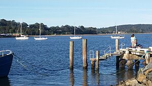
The community works hard to keep their beach amazing. There's an old community boat shed from the 1930s that local boat owners still take care of. People are also trying to protect the sand dunes after storms caused damage years ago. They remove weeds and plant native trees, and it's working well!
The judges were super impressed by how much the community gets involved. They said that locals, even part-time residents who only visit for holidays, come together for beach clean-ups and working bees. Sometimes, up to 70% of the local population joins in! This shows how dedicated the Rosedale community is to keeping their beach clean and healthy.
Batemans Marine Park
The Batemans Marine Park was created on June 30, 2007, and it includes all the waters around Rosedale. This park helps protect the ocean and its creatures.
The waters around Rosedale are divided into two special zones:
- Habitat Protection Zone: This zone covers Rosedale's beaches and coves, extending north past Batemans Bay. In this area, there are some rules for recreational fishing (fishing for fun) and strict rules for commercial fishing (fishing for business).
- Burrewarra Point Sanctuary Zone: This zone includes Jimmies Island and extends south to Nuns Beach and Guerilla Bay. In this very special zone, all recreational and commercial fishing is completely forbidden. This is because the Burrewarra Point Sanctuary Zone is an important breeding ground for critically endangered grey nurse sharks. It's a safe place for them to grow their families!
Nature Walks
If you love nature, the Rosedale - Guerilla Bay Circuit is a popular walking track. It starts at the southern end of Tranquil Bay Place in Rosedale and finishes at Guerilla Bay. Along the walk, you might spot sea eagles and cockatoos. You'll also cross Nuns Beach and get amazing views of Jimmies Island and Guerilla Bay.
 | DeHart Hubbard |
 | Wilma Rudolph |
 | Jesse Owens |
 | Jackie Joyner-Kersee |
 | Major Taylor |


