Ross Creek Reservoir facts for kids
Quick facts for kids Ross Creek Reservoir |
|
|---|---|
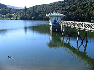
Ross Creek Reservoir in 2009, looking north. Valve tower to the right.
|
|
| Location | Dunedin, South Island |
| Coordinates | 45°50′50″S 170°29′55″E / 45.8471°S 170.4986°E |
| Type | reservoir |
| Primary inflows | Ross Creek, Wakari Creek |
| Primary outflows | Ross Creek |
| Basin countries | New Zealand |
| Max. length | approx. 350 m (1,150 ft) |
| Max. width | approx. 80 m (260 ft) |
| Average depth | 30 m (98 ft) |
| Water volume | 162,000 m3 (131 acre⋅ft) |
| Surface elevation | 115 metres (377 ft) ASL |
| Settlements | Dunedin |
The Ross Creek Reservoir is a special human-made lake in Dunedin, New Zealand. It's one of the oldest human-made lakes in the country. It's also the oldest water supply reservoir still used today!
It was built in the 1860s to give water to Dunedin. At that time, Dunedin was growing very fast. This was because of the Otago goldrush, when many people came looking for gold.
Engineer Ralph Donkin and builder David Proudfoot designed it. The reservoir opened in 1867. It was first called the Royal Albert Reservoir. But people didn't like that name much. For over 100 years, it has been known as the Ross Creek Reservoir.
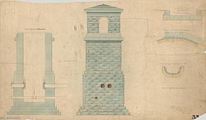
The reservoir, its dams, and its pretty valve tower are very important. They are listed as a Level I heritage site by Heritage New Zealand. This means they are historically very significant.
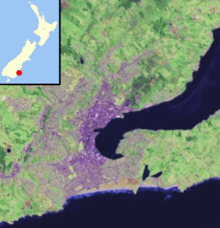
The reservoir is in a valley with lots of trees. This area is called Glenleith. It's about four kilometres north of Dunedin city centre. Small streams like Ross Creek and Wakari Creek flow into it. Ross Creek is a branch of the Water of Leith. The water is held back by two small dams. One dam is 23 metres tall, and the other is 10 metres tall. The water surface is about 115 metres above sea level.
Exploring Ross Creek Reserve
The reservoir is surrounded by a public area called the Ross Creek Reserve. This area has been allowed to grow back with native New Zealand plants. Even though it's not officially a "reserve" by law, the Dunedin City Council looks after it. They treat it like a reserve because it's so beautiful and great for outdoor fun.
The reserve is located between Tanner and Rockside Roads in Glenleith. It also reaches Cannington Road in Maori Hill. A winding road called Burma Road goes through the reserve. It runs north and west of the reservoir. The Balmacewen Golf Course is right next to the reserve's southwest side. The highest point in the reserve is about 190 metres above sea level.
Fun Walking Tracks
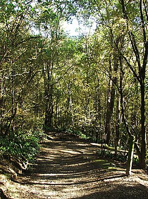
There are many popular walking tracks around the reservoir. These paths also follow Ross Creek and School Creek. Special counters have shown that up to 4,000 people walk on these tracks each month! This makes them some of Dunedin's most used bush walks.
The tracks have stone markers to guide you. There's also a special orienteering course with numbered posts. You can start these walks from different spots. These include places along Burma and Tanner Roads. The main starting point is lower down Ross Creek in Glenleith.
Another track connects the reserve to a walkway. This path follows the Water of Leith. It goes past an old quarry. Then it links up with paths in Woodhaugh Gardens. This is about 0.9 kilometres to the southeast.
Cool Features to See
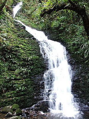
Besides the reservoir itself, the reserve has other cool things to see. One is a waterfall that drops about 20 metres into School Creek. This waterfall looks completely natural. But it was actually created when Ross Creek was moved to fill the reservoir. Now, it carries water from the creek's flood channel.
The lower parts of the reserve's tracks near Glenleith are also special. They go through the narrowest part of the Ross Creek valley. Here, the valley walls rise up like a canyon on both sides of the path and the creek. It's a really cool place to explore!
 | James Van Der Zee |
 | Alma Thomas |
 | Ellis Wilson |
 | Margaret Taylor-Burroughs |


