Roughedge, North Carolina facts for kids
Quick facts for kids
Roughedge
|
|
|---|---|
| Country | United States |
| State | North Carolina |
| County | Union County |
| Elevation | 705 ft (215 m) |
| Time zone | UTC-5 (Eastern (EST)) |
| • Summer (DST) | UTC-4 (EDT) |
| ZIP code |
28112
|
| Area code(s) | 704, 980 |
| GNIS feature ID | 1022407 |
Roughedge is a small place in Union County, North Carolina, in the United States. It is known as an "unincorporated community." This means it is a group of homes and businesses that does not have its own local government, unlike a city or town.
You can find Roughedge located southwest of a larger town called Monroe. It is right where two important roads meet: North Carolina Highway 200 (also called Lancaster Highway) and North Carolina Highway 522 (known as Rocky River Road).
Contents
What is an Unincorporated Community?
An unincorporated community like Roughedge is a place where people live close together, but it is not officially a city or town. It does not have its own mayor or city council. Instead, the county government, which is Union County in this case, provides services like roads and law enforcement.
How is it Different from a City?
Cities and towns have their own local governments. These governments can make their own laws, collect taxes for local services, and have their own police and fire departments. Unincorporated communities rely on the county for these services.
Location and Geography
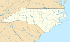
Roughedge is located in Union County, which is in the southern part of North Carolina. North Carolina is a state on the East Coast of the United States.
Roads and Travel
The community is easy to find because it sits at a crossroads. North Carolina Highway 200 runs through it, connecting it to other areas. North Carolina Highway 522 also crosses here, making it a central point for local travel.
Elevation
Roughedge is located about 215 meters (or 705 feet) above sea level. This measurement tells us how high the land is compared to the ocean.
 | William Lucy |
 | Charles Hayes |
 | Cleveland Robinson |


