Roxbury, Illinois facts for kids
Quick facts for kids
Roxbury, Illinois
|
|
|---|---|
 |
|
| Country | United States |
| State | Illinois |
| County | Lee |
| Township | Wyoming |
| Elevation | 892 ft (272 m) |
| Time zone | UTC-6 (Central (CST)) |
| • Summer (DST) | UTC-5 (CDT) |
| Area code(s) | 815 & 779 |
| GNIS feature ID | 423137 |
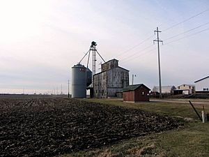
Roxbury is a small place in Lee County, Illinois, United States. It is known as an "unincorporated community." This means it is a group of homes and buildings that does not have its own local government, like a city or town. Instead, it is managed as part of the larger county.
Where is Roxbury Located?
Roxbury is found in the state of Illinois. Illinois is in the central part of the United States. The community is located on County Route 10.
It is about 3.1 miles (which is about 5 kilometers) west-northwest of a town called Paw Paw. Roxbury sits at an elevation of 892 feet (or 272 meters) above sea level.
Time Zone Information
Roxbury is in the Central Time Zone (CST). During certain times of the year, it observes Daylight Saving Time, which is called CDT. This means the clocks are set forward one hour in the spring and back one hour in the fall.


