Roxbury, Pennsylvania facts for kids
Quick facts for kids
Roxbury, Pennsylvania
|
|
|---|---|
|
Unincorporated community
|
|

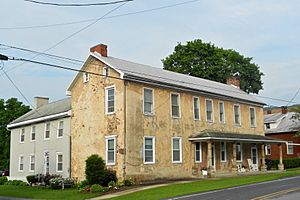
House in Roxbury
|
|
| Country | United States |
| State | Pennsylvania |
| County | Franklin |
| Township | Lurgan |
| Elevation | 748 ft (228 m) |
| Time zone | UTC-5 (Eastern (EST)) |
| • Summer (DST) | UTC-4 (EDT) |
| ZIP code |
17251
|
| Area code(s) | 717 |
| GNIS feature ID | 1185584 |
Roxbury is a small place in Pennsylvania, United States. It is an unincorporated community, which means it doesn't have its own local government like a city or town. Instead, it's part of a larger area called Lurgan Township.
Roxbury is located in Franklin County. You can find it right off the Blue Mountain exit of the Pennsylvania Turnpike. This turnpike is also known as Interstate 76. Two important roads, Route 641 and Route 997, also meet here.
History of Roxbury
Roxbury was first planned and settled around the year 1778. This was a long time ago, even before the United States was fully formed! A post office was opened in Roxbury in 1822. This helped people send and receive letters and packages.
Famous People from Roxbury
Carl Cover: Aviation Pioneer
One notable person from Roxbury was Carl Cover. He was born in 1893 and lived until 1944. Carl Cover was an important figure in the early days of aviation. He was known as an aviation pioneer, meaning he helped develop and explore flying when it was still very new. His work helped make airplanes what they are today.
 | James B. Knighten |
 | Azellia White |
 | Willa Brown |


