Rumford, South Dakota facts for kids
Quick facts for kids
Rumford, South Dakota
|
|
|---|---|
| Country | United States |
| State | South Dakota |
| County | Fall River |
| Elevation | 3,517 ft (1,072 m) |
| Time zone | UTC-7 (Mountain (MST)) |
| • Summer (DST) | UTC-6 (MDT) |
| Area code(s) | 605 |
| FIPS code | 46-56700 |
| GNIS feature ID | 1262342 |
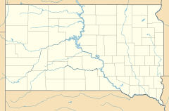
Rumford is a small place in Fall River County, South Dakota, United States. It's called an unincorporated community. This means it's a group of homes or buildings that isn't officially a town or city with its own local government.
Rumford is found on South Dakota Highway 471. It is about 19 miles (31 km) southeast of a town called Edgemont. Even though Rumford is a distinct place, it shares a ZIP code (57735) with Edgemont and other nearby areas. This is common for smaller communities.
The Story of Rumford
How Rumford Began
Rumford started in 1889. This was when the Burlington Northern railroad company was building new tracks. They decided to put a train station in this spot.
A Name Change
At first, the railroad company called the station "Siding No. 5." But in 1894, they changed its name to Rumford. This is how the community got its name.
 | Selma Burke |
 | Pauline Powell Burns |
 | Frederick J. Brown |
 | Robert Blackburn |


