Ségrie facts for kids
Quick facts for kids
Ségrie
|
|
|---|---|

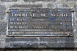
A distance plaque in Ségrie
|
|
| Country | France |
| Region | Pays de la Loire |
| Department | Sarthe |
| Arrondissement | Mamers |
| Canton | Beaumont-sur-Sarthe |
| Intercommunality | Communauté de communes du Pays Belmontais (Sarthe) |
| Area
1
|
22.2 km2 (8.6 sq mi) |
| Population
(2006)
|
594 |
| • Density | 26.76/km2 (69.30/sq mi) |
| Time zone | UTC+01:00 (CET) |
| • Summer (DST) | UTC+02:00 (CEST) |
| INSEE/Postal code |
72332 /72170
|
| Elevation | 60–199 m (197–653 ft) |
| 1 French Land Register data, which excludes lakes, ponds, glaciers > 1 km2 (0.386 sq mi or 247 acres) and river estuaries. | |
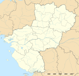
Ségrie is a small village, also known as a commune, located in the western part of France. It is found in the Pays de la Loire region. Ségrie is part of the Sarthe department.
Contents
Ségrie: A French Village
Ségrie is a quiet and charming commune in the French countryside. It is a place where people live and work. The village is known for its peaceful atmosphere. It offers a glimpse into traditional French life.
Where is Ségrie?
Ségrie is in the Sarthe department. This department is in the Pays de la Loire region. This region is in western France. Ségrie is located in the Mamers area. It is also part of the Beaumont-sur-Sarthe canton. These are ways France organizes its local areas.
Life in Ségrie
In 2006, about 594 people lived in Ségrie. This makes it a small community. People in Ségrie live in a rural setting. They enjoy the quiet life of the French countryside. The village is a place where neighbors know each other.
Who Leads Ségrie?
Like all communes in France, Ségrie has a mayor. The mayor is the head of the local government. From 2008 to 2014, Francis Lépinette was the mayor. He belonged to the LGM political party. The mayor helps manage the village. They work on local services and community projects.
How Big is Ségrie?
Ségrie covers an area of 22.2 square kilometers. This is about 8.6 square miles. The village is located at different heights above sea level. The lowest point is 60 meters (197 feet) high. The highest point is 199 meters (653 feet) high. This means the land has some gentle slopes.
See also
 In Spanish: Ségrie para niños


