Saïda Province facts for kids
Quick facts for kids
Saïda Province
ولاية سعيدة
|
|
|---|---|

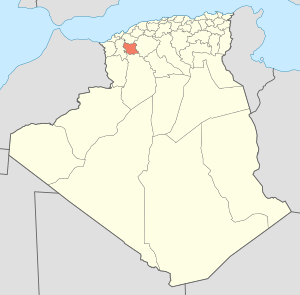
Map of Algeria highlighting Saïda
|
|
| Country | |
| Capital | Saïda |
| Area | |
| • Total | 6,764 km2 (2,612 sq mi) |
| Population
(2008)
|
|
| • Total | 328,685 |
| • Density | 48.593/km2 (125.856/sq mi) |
| Time zone | UTC+01 (CET) |
| Area Code | +213 (0) 48 |
| ISO 3166 code | DZ-20 |
| Districts | 6 |
| Municipalities | 16 |
Saïda Province is a region in Algeria, a country in North Africa. It is named after its main city, Saïda, which is also its capital. This province is known for its beautiful natural areas and important historical sites.
Contents
What is Saïda Province?
Saïda Province is one of Algeria's many provinces. Think of a province like a state or a large county in other countries. It was officially created in 1974. The province covers an area of about 6,764 square kilometers.
How Many People Live Here?
According to a 2008 count, about 328,685 people live in Saïda Province. This makes it a moderately populated area in Algeria.
Where is Saïda Province Located?
Saïda Province is located in the western part of Algeria. Its coordinates are roughly 34°50′ North and 0°09′ East. This means it's in the northern hemisphere, just a bit north of the equator.
How is Saïda Province Organized?
The province is divided into smaller parts to help manage it. These parts are called districts and municipalities.
Districts of Saïda Province
Saïda Province has 6 main districts. Each district is like a smaller administrative area within the province.
- Aïn El Hadjar
- El Hassasna
- Ouled Brahim
- Saïda
- Sidi Boubekeur
- Youb
Municipalities of Saïda Province
Within these 6 districts, there are 16 communes or municipalities. These are like local towns or villages, each with its own local government.
See also

- In Spanish: Provincia de Saida para niños
 | Laphonza Butler |
 | Daisy Bates |
 | Elizabeth Piper Ensley |

