Saddell Bay facts for kids
Quick facts for kids Saddell Bay |
|
|---|---|
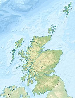
| Location | eastern side of the Kintyre Peninsula of Scotland |
| Coordinates | 55°31.72′N 5°29.98′W / 55.52867°N 5.49967°W |
| Type | embayment |
Saddell Bay is a beautiful bay located on the eastern side of the Kintyre Peninsula in Scotland. A bay is like a curve in the coastline where the land goes inward. This bay is part of the Kilbrannan Sound, which is a stretch of water that separates the Kintyre Peninsula from the Isle of Arran. There are other bays nearby, like Kildonald Bay and Dippen Bay.
What Saddell Bay Looks Like
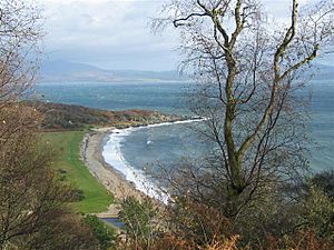
Saddell Bay is about 1 kilometer (or 0.6 miles) long. It stretches from Pluck Point in the northeast to Port na Cuthaig in the southwest. A small river called Saddell Water flows into the sea at the southwest end of the bay.
Between the river mouth and Pluck Point, you'll find a sandy beach. Behind this beach is something called a "storm beach." This is a ridge of grass-covered land. It was formed when strong waves threw large rocks and boulders up onto the beach. Over time, these rocks became covered with grass, making a ridge that is higher than the land behind it.
Interesting Buildings at Saddell Bay
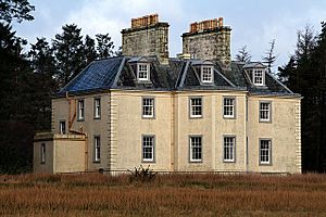
There are several interesting buildings near Saddell Bay. Saddell Castle is a historic castle located close to the beach, on the west side of Saddell Water. Saddell House, which was built around 1774, is to the east of Saddell Water. It sits behind the grassy storm beach ridge.
Near the shore, southwest of the castle, are three smaller buildings: Shore Cottage, Ferryman's Cottage, and Cul na Shee. Saddell Lodge is located by the gate where the road leads down to the shore.
All these buildings are owned by the Landmark Trust. This organization takes old, important buildings and restores them. Then, they rent them out as vacation homes.
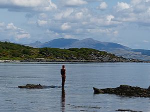
In 2015, the Landmark Trust celebrated its 50th anniversary. To mark this special occasion, they asked a famous artist named Antony Gormley to create five sculptures. Four of these sculptures were placed at different points around Great Britain, and one was in the middle. The sculpture for the northern part of Great Britain was placed at Saddell Bay, near Shore Cottage. It looks out across the Kilbrannan Sound towards the Isle of Arran. This particular sculpture is the only one of the five that was kept permanently.


