Saint-Pierre-du-Lorouër facts for kids
Quick facts for kids
Saint-Pierre-du-Lorouër
|
|
|---|---|

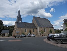
The church of Saint-Pierre-du-Lorouër
|
|
| Country | France |
| Region | Pays de la Loire |
| Department | Sarthe |
| Arrondissement | La Flèche |
| Canton | Château-du-Loir |
| Intercommunality | Loir-Lucé-Bercé |
| Area
1
|
16.55 km2 (6.39 sq mi) |
| Population
(Jan. 2021)
|
Lua error in Module:Wd at line 1,575: attempt to index field 'wikibase' (a nil value). |
| Time zone | UTC+01:00 (CET) |
| • Summer (DST) | UTC+02:00 (CEST) |
| INSEE/Postal code |
72314 /72150
|
| Elevation | 58–147 m (190–482 ft) |
| 1 French Land Register data, which excludes lakes, ponds, glaciers > 1 km2 (0.386 sq mi or 247 acres) and river estuaries. | |
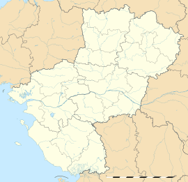
Saint-Pierre-du-Lorouër is a commune. It is found in the region Pays de la Loire in the Sarthe department in the west of France.
See also
 In Spanish: Saint-Pierre-du-Lorouër para niños

All content from Kiddle encyclopedia articles (including the article images and facts) can be freely used under Attribution-ShareAlike license, unless stated otherwise. Cite this article:
Saint-Pierre-du-Lorouër Facts for Kids. Kiddle Encyclopedia.

