San Andrés Itzapa facts for kids
Quick facts for kids
San Andrés Itzapa
|
|
|---|---|
|
Municipality and town
|
|
| Country | |
| Department | |
| Area | |
| • Total | 24.6 sq mi (63.7 km2) |
| Population
(2018 census)
|
|
| • Total | 32,083 |
| • Density | 1,304.5/sq mi (503.7/km2) |
| Demonym(s) | Itzapecos |
| Time zone | UTC+6 (Central Time) |
| Climate | Cwb |
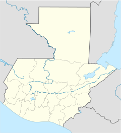
San Andrés Itzapa is a town and a municipality in the Chimaltenango area of Guatemala. In 2018, about 24,992 people lived in the town. The whole municipality covers an area of 63.7 square kilometers and has a total population of 32,083. San Andrés Itzapa is located in the eastern part of Chimaltenango.
Contents
What's in a Name?
The name San Andrés Itzapa has a special meaning. "Itzapa" means "flint," which is a type of hard stone. This town is very old! It was even mentioned in a book called the Annals of the Cakchiquels back in 1571. When the Spanish arrived, they named the area "Itzapa y de San Andrés." They did this to honor their patron saint, Saint Andrew. The Spanish also called the area "Valle del Durazno," which means "Valley of the Peaches." This was because the prickly pear plants there reminded them of peach orchards back home.
Languages Spoken
In San Andrés Itzapa, people mainly speak two languages: Spanish and Kaqchiquel. However, people have moved here from other places, bringing more languages. You might also hear Kʼicheʼ and Tzʼutujil spoken in the area.
Plants and Animals
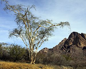
San Andrés Itzapa has many areas covered by forests. These forests are home to different types of trees like eucalyptus, poplars, pines, oaks, and cypress. You can also find plants such as canaque, casuarina, and palo blanco.
Many animals live in this region too. You might see coyotes, armadillos, and even mountain lions. Other animals include squirrels, raccoons, wild boars, and various birds like doves and pheasants.
Farm Products
Farmers in San Andrés Itzapa grow many different crops. These include important foods like wheat, corn, and beans. They also grow vegetables such as avocado, chayote, beets, radishes, squash, carrots, broccoli, and cabbage. Coffee and guaque Chile peppers are also grown here.
Local Crafts
The people of San Andrés Itzapa are very skilled at making things by hand. They are known for their leather goods, like sheaths for knives and machetes, and sandals. They also create beautiful items from jade. Other crafts include making tables, chairs, and ropes.
Fun Celebrations
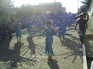
San Andrés Itzapa has several exciting celebrations throughout the year:
- Convite: This celebration happens on the last Saturday of January.
- Feria Titular: This is a big fair that takes place from November 22nd to December 1st.
- Corpus Christi: Celebrated in late June.
- Corrida de Cintas: This event is held on September 15th.
- Maximón: A special day for Maximón is celebrated on October 28th.
- Saint Andrew the Apostle: The town honors its patron saint on November 30th.
Cool Places to Visit
- Xipacay bath: A place where you can relax and enjoy the water.
- Temple of San Simón: A unique temple dedicated to San Simón.
Volunteer Groups Helping Out
Several groups work to help the community in San Andrés Itzapa:
- DOCARE Clinic: This is a medical program from the United States. It started in 2011 and works with a local Guatemalan group called ASSADE. The clinic has a full-time doctor and nurse. They also welcome medical students and doctors from American programs who volunteer to help people.
- Maya Pedal: This local group helps rural areas by designing and building machines powered by pedals, called bicimaquinas.
- Project Genesis: This local group offers education and community programs for children in San Andrés and nearby villages. They plan to build a school and hire full-time teachers. The project gets help from volunteers from other countries.
Climate and Weather
San Andrés Itzapa has a subtropical highland climate. This means it has mild temperatures all year round, with a rainy season and a dry season.
| Climate data for San Andrés Itzapa | |||||||||||||
|---|---|---|---|---|---|---|---|---|---|---|---|---|---|
| Month | Jan | Feb | Mar | Apr | May | Jun | Jul | Aug | Sep | Oct | Nov | Dec | Year |
| Mean daily maximum °C (°F) | 21.7 (71.1) |
22.6 (72.7) |
24.2 (75.6) |
24.7 (76.5) |
24.4 (75.9) |
22.5 (72.5) |
22.7 (72.9) |
23.1 (73.6) |
22.5 (72.5) |
21.8 (71.2) |
21.9 (71.4) |
21.6 (70.9) |
22.8 (73.1) |
| Daily mean °C (°F) | 15.5 (59.9) |
16.1 (61.0) |
17.4 (63.3) |
18.6 (65.5) |
18.9 (66.0) |
18.1 (64.6) |
17.9 (64.2) |
17.9 (64.2) |
17.8 (64.0) |
17.1 (62.8) |
16.4 (61.5) |
15.5 (59.9) |
17.3 (63.1) |
| Mean daily minimum °C (°F) | 9.3 (48.7) |
9.6 (49.3) |
10.6 (51.1) |
12.5 (54.5) |
13.4 (56.1) |
13.8 (56.8) |
13.2 (55.8) |
12.8 (55.0) |
13.1 (55.6) |
12.4 (54.3) |
11.0 (51.8) |
9.5 (49.1) |
11.8 (53.2) |
| Average precipitation mm (inches) | 3 (0.1) |
4 (0.2) |
4 (0.2) |
37 (1.5) |
113 (4.4) |
277 (10.9) |
199 (7.8) |
187 (7.4) |
263 (10.4) |
139 (5.5) |
36 (1.4) |
8 (0.3) |
1,270 (50.1) |
| Source: Climate-Data.org | |||||||||||||
Where is San Andrés Itzapa?
San Andrés Itzapa is surrounded by other towns in the Chimaltenango Department.
 |
Zaragoza | Chimaltenango | Chimaltenango |  |
| Zaragoza and Patzicía | Parramos | |||
| Acatenango |
See also
 In Spanish: San Andrés Itzapa para niños
 | Madam C. J. Walker |
 | Janet Emerson Bashen |
 | Annie Turnbo Malone |
 | Maggie L. Walker |


