San Antonio de Los Altos facts for kids
Quick facts for kids
San Antonio de Los Altos
|
|||
|---|---|---|---|
 |
|||
|
|||
| Country | |||
| State | Miranda | ||
| Municipality | Los Salias Municipality | ||
| Founded | 1 May 1683 | ||
| Area | |||
| • Total | 51 km2 (20 sq mi) | ||
| Elevation | 1,600 m (5,200 ft) | ||
| Population | |||
| • Total | 74,422 | ||
| • Demonym | Sanantoñero/a | ||
| Time zone | VST | ||
| Postal code |
1204
|
||
| Area code(s) | 0212 | ||
| Climate | Cwb | ||
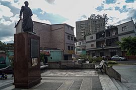
San Antonio de Los Altos is a town in Venezuela. It's like a suburb, which means it's a smaller town near a bigger city. It is the main town of the Los Salias Municipality in Miranda State. In 2011, about 68,255 people lived there.
The town got its name from Saint Anthony of Padua. He was a Catholic priest from Portugal. He is considered the special protector or "patron saint" of the city and the mountains around it.
Exploring San Antonio de Los Altos
San Antonio de Los Altos is a cool place to learn about geography and how towns are connected. It's part of a larger area called the Altos Mirandinos Metropolitan Area. This area is also part of the even bigger Metropolitan Region of Caracas.
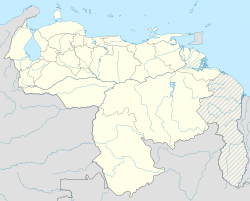
Where is San Antonio de Los Altos?
The town covers an area of about 55 square kilometers. That's about 21 square miles! It sits high up, around 1,300 meters (or 4,265 feet) above sea level. This makes San Antonio the highest point in the whole Altos Mirandinos area. Imagine the views from up there!
See also
 In Spanish: San Antonio de Los Altos para niños
 | Leon Lynch |
 | Milton P. Webster |
 | Ferdinand Smith |


