
San Antonio del Táchira facts for kids
Quick facts for kids
San Antonio del Táchira
|
|||
|---|---|---|---|
 |
|||
|
|||
| Country | Venezuela | ||
| State | Táchira | ||
| Municipality | Bolívar | ||
| Founded | 1724 | ||
| Area | |||
| • Total | 204 km2 (79 sq mi) | ||
| Elevation | 802 m (2,631 ft) | ||
| Population
(2011)
|
|||
| • Total | 61,630 | ||
| • Density | 236.13/km2 (611.6/sq mi) | ||
| Time zone | UTC−4 (VET) | ||
| Area code(s) | 0276 | ||
| Climate | BSh | ||
| Website | bolivar-tachira.gob.ve | ||
| The area and population figures are for the municipality | |||


San Antonio del Táchira is a city in the Táchira state of Venezuela. This state is located in the Andes mountains. The city is a very important gateway between Venezuela and Colombia. This is because a busy highway crosses the Simón Bolívar International Bridge here. This bridge connects the cities of Cúcuta in Colombia and San Cristóbal in Venezuela.
San Antonio del Táchira is the main town of the Bolívar Municipality in Táchira. In 2011, the municipality had a population of about 61,630 people.
Contents
History of San Antonio del Táchira
A very famous person in South American history, General Simón Bolívar, traveled through San Antonio del Táchira. This happened on March 1, 1813, during his important military journey called the Admirable Campaign.
People and Population
The Bolívar Municipality is where San Antonio del Táchira is located. In 2001, the municipality had a population of 48,171 people. This number grew from 39,752 people in 1990. By 2011, the population had increased to about 61,630 people. This means that about 4.9% of all the people in Táchira state live in this municipality.
Economy and Travel
San Antonio del Táchira is important for trade and travel between Venezuela and Colombia.
Getting Around: Transportation
Airport
The city has its own airport called Juan Vicente Gómez International Airport. It is located just 2 kilometers (about 1.2 miles) northeast of the city center.
Bridges
The Simón Bolívar International Bridge is a very important bridge here. It crosses the Táchira River and connects San Antonio del Táchira with the city of Cúcuta in Colombia.
Places to Visit
San Antonio del Táchira has some nice public spaces where people can relax.
Squares and Parks
- Plaza Bolívar: This square is located between Carrera 9 and 10, and Calle 3 and 4.
- Plaza Miranda: This square can be found between Carrera 12 and 13, and Calle 4 and 5.
Climate
The weather in San Antonio del Táchira is generally warm. It has a tropical savanna climate. This means it's usually hot all year, with a wet season and a dry season.
| Climate data for San Antonio Del Tachira (1971–2000) | |||||||||||||
|---|---|---|---|---|---|---|---|---|---|---|---|---|---|
| Month | Jan | Feb | Mar | Apr | May | Jun | Jul | Aug | Sep | Oct | Nov | Dec | Year |
| Mean daily maximum °C (°F) | 30.5 (86.9) |
30.7 (87.3) |
30.8 (87.4) |
31.4 (88.5) |
32.3 (90.1) |
31.8 (89.2) |
31.9 (89.4) |
32.8 (91.0) |
33.2 (91.8) |
32.6 (90.7) |
31.5 (88.7) |
30.6 (87.1) |
31.7 (89.0) |
| Mean daily minimum °C (°F) | 20.6 (69.1) |
20.9 (69.6) |
21.4 (70.5) |
22.0 (71.6) |
22.9 (73.2) |
23.3 (73.9) |
23.0 (73.4) |
23.1 (73.6) |
22.7 (72.9) |
22.1 (71.8) |
21.5 (70.7) |
20.8 (69.4) |
22.0 (71.6) |
| Average precipitation mm (inches) | 40.7 (1.60) |
36.8 (1.45) |
49.4 (1.94) |
99.4 (3.91) |
71.4 (2.81) |
27.9 (1.10) |
27.6 (1.09) |
32.9 (1.30) |
62.5 (2.46) |
110.1 (4.33) |
100.1 (3.94) |
62.5 (2.46) |
721.3 (28.39) |
| Average precipitation days (≥ 0.1 mm) | 7.9 | 7.3 | 9.5 | 11.3 | 12.3 | 12.2 | 12.0 | 12.8 | 13.8 | 14.3 | 13.4 | 9.9 | 136.7 |
| Source: World Meteorological Organization | |||||||||||||
Images for kids
-
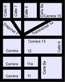
This image shows how streets are often arranged in a grid pattern, like in San Antonio del Táchira.

See also
 In Spanish: San Antonio del Táchira para niños
