San Francisco de los Romo facts for kids
Quick facts for kids
San Francisco de los Romo
|
|
|---|---|
 |
|

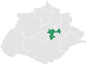
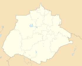
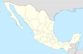
Municipality location in Aguascalientes
|
|
| Country | Mexico |
| State | Aguascalientes |
| Area | |
| • Land | 139.452 km2 (53.843 sq mi) |
| Population
(2015)
|
|
| • Total | 46,454 |
| • Density | 333.1/km2 (863/sq mi) |
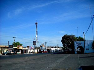
San Francisco de los Romo is a city and a special area called a municipality in the Mexican state of Aguascalientes. The city of San Francisco de los Romo is the main town for the whole municipality around it.
This area is in the middle of the Aguascalientes Valley. It is about 20 kilometers (12 miles) north of the state capital, also called Aguascalientes. San Francisco de los Romo shares borders with other municipalities. To the north, it borders Pabellón de Arteaga and Asientos. To the west, it borders Jesús María. To the southeast, it borders Aguascalientes. The city itself is in the northwest part of the municipality. It is the sixth-largest community in the state.
Population and People
This section talks about the number of people living in San Francisco de los Romo. It also looks at how the population has changed over time.
| Historical population | ||
|---|---|---|
| Year | Pop. | ±% |
| 2010 | 35,769 | — |
| 2015 | 46,454 | +29.9% |
| 2020 | 61,997 | +33.5% |
In 2010, the entire municipality had a total population of 35,769 people.
The city of San Francisco de los Romo itself had 16,124 people in 2010. Besides the main city, the municipality has 117 smaller communities. Some of the largest communities in 2010 were:
- Ex-viñedos Guadalupe (3,499 people) - This is considered an urban area.
- Colonia Macario J. Gómez (2,122 people)
- Puertecito de la Virgen (1,976 people)
- Paseos de la Providencia (1,867 people)
- La Concepción (1,483 people)
- La Escondida (El Salero) (1,318 people)
These last five are considered rural areas.
San Francisco de los Romo is the sixth-biggest community in the state. It is located in the northwest part of its municipality and acts as the main center for local government.
Weather and Environment
This part tells us about the weather patterns in San Francisco de los Romo.
Climate Information
The climate in San Francisco de los Romo is generally mild. It has warm summers and cool winters. The area gets most of its rain during the summer months.
| Climate data for San Francisco de los Romo (1951–2010) | |||||||||||||
|---|---|---|---|---|---|---|---|---|---|---|---|---|---|
| Month | Jan | Feb | Mar | Apr | May | Jun | Jul | Aug | Sep | Oct | Nov | Dec | Year |
| Record high °C (°F) | 35.0 (95.0) |
37.0 (98.6) |
39.0 (102.2) |
43.0 (109.4) |
44.0 (111.2) |
42.0 (107.6) |
40.0 (104.0) |
39.0 (102.2) |
38.0 (100.4) |
39.0 (102.2) |
34.0 (93.2) |
38.0 (100.4) |
44.0 (111.2) |
| Mean daily maximum °C (°F) | 22.9 (73.2) |
24.7 (76.5) |
28.2 (82.8) |
30.9 (87.6) |
32.6 (90.7) |
31.4 (88.5) |
28.9 (84.0) |
29.0 (84.2) |
27.7 (81.9) |
26.4 (79.5) |
24.7 (76.5) |
22.5 (72.5) |
27.5 (81.5) |
| Daily mean °C (°F) | 12.7 (54.9) |
13.9 (57.0) |
16.8 (62.2) |
19.6 (67.3) |
21.8 (71.2) |
22.5 (72.5) |
21.1 (70.0) |
20.9 (69.6) |
19.9 (67.8) |
17.5 (63.5) |
14.8 (58.6) |
13.1 (55.6) |
17.9 (64.2) |
| Mean daily minimum °C (°F) | 2.5 (36.5) |
3.1 (37.6) |
5.3 (41.5) |
8.2 (46.8) |
11.1 (52.0) |
13.6 (56.5) |
13.2 (55.8) |
12.9 (55.2) |
12.1 (53.8) |
8.5 (47.3) |
4.8 (40.6) |
3.7 (38.7) |
8.3 (46.9) |
| Record low °C (°F) | −8.0 (17.6) |
−6.2 (20.8) |
−6.2 (20.8) |
−0.8 (30.6) |
0.0 (32.0) |
5.0 (41.0) |
5.0 (41.0) |
5.4 (41.7) |
2.0 (35.6) |
−4.1 (24.6) |
−4.2 (24.4) |
−6.0 (21.2) |
−8.0 (17.6) |
| Average precipitation mm (inches) | 15.5 (0.61) |
8.6 (0.34) |
7.3 (0.29) |
10.7 (0.42) |
19.5 (0.77) |
72.5 (2.85) |
94.5 (3.72) |
98.0 (3.86) |
87.1 (3.43) |
31.5 (1.24) |
12.6 (0.50) |
15.2 (0.60) |
473.0 (18.62) |
| Average precipitation days (≥ 0.1 mm) | 2.2 | 1.3 | 0.8 | 1.5 | 3.0 | 7.8 | 10.2 | 10.5 | 8.9 | 4.9 | 1.6 | 2.2 | 54.9 |
| Source: Servicio Meteorologico Nacional | |||||||||||||
See also
 In Spanish: San Francisco de los Romo para niños
 | Leon Lynch |
 | Milton P. Webster |
 | Ferdinand Smith |


