San Mateo, New Mexico facts for kids
Quick facts for kids
San Mateo, New Mexico
|
|
|---|---|
| Country | United States |
| State | New Mexico |
| County | Cibola |
| Area | |
| • Total | 2.78 sq mi (7.19 km2) |
| • Land | 2.77 sq mi (7.19 km2) |
| • Water | 0.00 sq mi (0.01 km2) |
| Elevation | 7,225 ft (2,202 m) |
| Population
(2020)
|
|
| • Total | 139 |
| • Density | 50.11/sq mi (19.35/km2) |
| Time zone | UTC-7 (Mountain (MST)) |
| • Summer (DST) | UTC-6 (MDT) |
| ZIP code |
87020
|
| Area code(s) | 505 |
| FIPS code | 35-35006 |
| GNIS feature ID | 2584209 |
San Mateo is a small community in Cibola County, New Mexico, United States. It is known as a census-designated place, which means it's a special area identified by the U.S. Census Bureau for collecting population data. In 2020, about 139 people lived there.
This community has a few important buildings. You can find a Catholic church and a Baptist church. There is also a Morada, which is a special meeting place for a religious group called the Penitentes. San Mateo also has a cemetery, a volunteer fire department, and an old elementary school that is no longer used. It is sometimes called "the Uranium Capital of the World" because of its history with uranium mining.
Where is San Mateo Located?
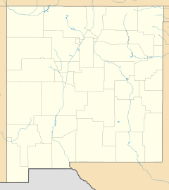
San Mateo is about 25 miles (40 km) away from Grants, another town in New Mexico. The community is located in a scenic area and offers views of Mount Taylor, a large mountain in the region.
Population Over Time
The number of people living in San Mateo has changed over the years. Here's a look at the population counts from recent U.S. Census reports:
| Historical population | |||
|---|---|---|---|
| Census | Pop. | %± | |
| 2020 | 139 | — | |
| U.S. Decennial Census | |||
See also
 In Spanish: San Mateo (Nuevo México) para niños
 | Laphonza Butler |
 | Daisy Bates |
 | Elizabeth Piper Ensley |


