San Mateo Río Hondo facts for kids
Quick facts for kids
San Mateo Río Hondo
|
|
|---|---|
|
Municipality and town
|
|
| Country | |
| State | Oaxaca |
| Area | |
| • Total | 81.96 km2 (31.64 sq mi) |
| Population
(2005)
|
|
| • Total | 3,495 |
| Time zone | UTC-6 (Central Standard Time) |
| • Summer (DST) | UTC-5 (Central Daylight Time) |
| Website | https://www.facebook.com/sanmateoriohondo |
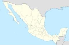
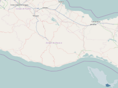
San Mateo Río Hondo is a town and a municipality located in the state of Oaxaca, Mexico. A municipality is like a local government area, similar to a county or district. This town is an important center for the communities around it.
Contents
Discover San Mateo Río Hondo
San Mateo Río Hondo is found in the Miahuatlán District. This area is in the southern part of the Sierra Sur Region. The town sits high up, about 2,300 meters (7,546 feet) above sea level.
A Look at History
Long ago, during the colonial era, this place was known by different names. In the Nahuatl language, it was called "Tetequipa." In the Zapotec language, its name was "Yegoyoxi." Both of these old names mean "river of sand," which tells us something about the area's natural features.
Communities and Governance
As the main town, San Mateo Río Hondo is the "municipal seat." This means it's where the local government is based. It also oversees many smaller communities nearby. These communities include:
- Barranca Grande
- El Campanario
- El Cuachepil
- El Encino
- El Esfuerzo
- El Manzanal
- El Naranjal
- El Progreso
- El Tavel
- Falda de Portillo
- Horno de Cal
- Jalatengo
- La Concepción
- La Doncella
- La Floreña
- La Victoria
- Las Nubes
- Las Tinas
- Loma San Marcial
- Miramar
- Piedra Gentil
- Pinabete (Llano de Pinabete)
- Ranchería Yogoló (Piedra Manchada)
- Rancho Cañas
- Rancho Cerezales
- Rancho Madroño (Rancho el Capulín)
- Rancho Nuevo
- Río Cuapinol
- Río Grande
- Río Molino
- Río Pacífico
- San Antonio
- San Felipe (Manzanillo)
- San Ildefonso Ozolotepec
- San José del Pacífico
- San Melchor
- San Pablo
- Tres Cruces
- Yogoló
- Zapotitlán
The municipality itself is divided into three main areas. These are the Nochixtlán district, the Mixtecan region, and San Mateo Sindihui.
Geography and Climate
San Mateo Río Hondo is surrounded by nature. The municipality has three notable hills:
- La Postura
- Zaniltepec
- Cerro León
The weather in this area is usually cool and often wet. This climate helps support the local plant and animal life.
Population and Size
According to a 2005 count, the total population of San Mateo Río Hondo was 3,495 people. The municipality covers an area of 81.96 square kilometers (about 31.64 square miles).
 | Claudette Colvin |
 | Myrlie Evers-Williams |
 | Alberta Odell Jones |


