San Pierre, Indiana facts for kids
Quick facts for kids
San Pierre, Indiana
|
|
|---|---|

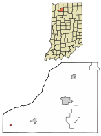
Location of San Pierre in Starke County, Indiana.
|
|
| Country | United States |
| State | Indiana |
| County | Starke |
| Township | Railroad |
| Area | |
| • Total | 0.14 sq mi (0.38 km2) |
| • Land | 0.14 sq mi (0.38 km2) |
| • Water | 0.00 sq mi (0.00 km2) |
| Elevation | 702 ft (214 m) |
| Population
(2020)
|
|
| • Total | 153 |
| • Density | 1,055.17/sq mi (407.09/km2) |
| Time zone | UTC-6 (Central (CST)) |
| • Summer (DST) | UTC-5 (CDT) |
| ZIP code |
46374
|
| Area code(s) | 219 |
| FIPS code | 18-68004 |
| GNIS feature ID | 2393222 |
San Pierre is a small community in Starke County, Indiana, United States. It is known as a census-designated place (CDP). This means it's a special area defined by the government for counting people. In 2020, about 153 people lived there. San Pierre is located in Railroad Township.
Contents
History of San Pierre's Name
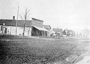
San Pierre was first set up in 1854. It was originally called Culvertown. Before that, in 1853, a post office opened there with the name River.
There are a couple of stories about how San Pierre got its name. One story says the town was named after a French-Canadian man named Pierre. He owned a place nearby where he sold drinks. People say the town moved a little closer to his place, and then they changed the name to San Pierre.
Another story says the town was named after a French railroad worker, also named Pierre. The word San was added to make the name sound more important.
Later, in 1894, the name was changed to just Pierre. This might have happened because of growing tensions between Spain and the United States. These tensions eventually led to the Spanish–American War. But in 1899, the name was changed back to San Pierre.
Sandhill Cranes: San Pierre's Special Birds
San Pierre is very close to the Jasper-Pulaski Fish and Wildlife Area. Because of this, every fall, more than 10,000 sandhill cranes visit the area. These large birds stop here during their long migration journey.
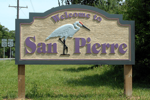
The sandhill crane has become a special symbol for San Pierre. You can even see a picture of this bird on the town's welcome sign!
San Pierre's Location
San Pierre is located where two main roads meet. These roads are U.S. Route 421 and Indiana State Road 10.
The community covers a total area of about 0.1 square miles (0.3 square kilometers). All of this area is land.
People of San Pierre
| Historical population | |||
|---|---|---|---|
| Census | Pop. | %± | |
| 2020 | 153 | — | |
| U.S. Decennial Census | |||
In 2020, the population of San Pierre was 153 people. In 2000, there were 156 people living in San Pierre. There were 71 households, which means 71 different homes. About 25% of these homes had children under 18 living there.
The average age of people in San Pierre in 2000 was 45 years old. About 22% of the population was under 18. About 25% of the people were 65 years or older.
Education in San Pierre
San Pierre has a public library. It is part of the Starke County Public Library System. This library helps people in the community learn and read.
See also
 In Spanish: San Pierre (Indiana) para niños
 | Claudette Colvin |
 | Myrlie Evers-Williams |
 | Alberta Odell Jones |


