San Ramón, Costa Rica facts for kids
Quick facts for kids
San Ramón
|
|
|---|---|
|
District
|
|

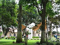
Central Park, Downtown San Ramón
|
|
| Country | |
| Province | Alajuela |
| Canton | San Ramón |
| Founded | 1854 |
| Area | |
| • Total | 1.28 km2 (0.49 sq mi) |
| Elevation | 1,057 m (3,468 ft) |
| Population
(2011)
|
|
| • Total | 8,717 |
| • Density | 6,810/km2 (17,640/sq mi) |
| Time zone | UTC−06:00 |
| Postal code |
20201
|
| Website | http://www.sanramon.go.cr/ |
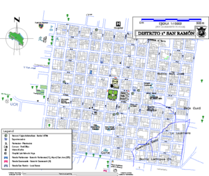
San Ramón is a special area, or district, located in the Alajuela Province of Costa Rica. It's part of a larger region also called San Ramón. This central district covers about 1.29 square kilometers (0.50 square miles) and is home to around 10,710 people. When people talk about "San Ramón City" (or Ciudad de San Ramón), they usually mean this district along with its neighboring areas.
San Ramón sits high up in the Cordillera de Tilarán mountains, about 1057 meters (3,468 feet) above sea level. It's a key link between the farming communities in the northern part of the Central Valley and the bigger cities like San Jose, Alajuela, Heredia, and Cartago. San Ramón is known for keeping its rich history and traditions alive.
Contents
San Ramón's Story: A Look Back
The history of San Ramón began in the early 1840s when European settlers arrived in this part of Costa Rica's central valley. These first settlers started traditional farms. Many of these farms are still running today, or they have changed to grow important crops for export. These crops include tropical plants, sugar cane, and coffee.
The name San Ramón was chosen by two important people who helped start the town: Ramon Salas (1838-1902) and Ramon Rodriguez (1818-1893). They named the area after Saint Raymond Nonnatus, putting it under his protection.
In 1854, San Ramón was officially recognized as a municipality. Just two years later, in 1856, five schools were opened. This was the start of San Ramón's reputation as a major center for education and, later, for business in the region. San Ramón has a rich history and is the hometown of famous poets like Lisimaco Chavarria and former presidents like Jose Figueres Ferrer. Its story from the 1800s includes events that shaped the entire country. For example, the "Liberacion Nacional Party" was created here, and the army was removed by former president "Don Pepe Figueres." Since 1876, San Ramón has also been the government center for Alajuela Province's second-largest district, which is also called San Ramón.
Where is San Ramón?
San Ramón is located about 55 kilometers (34 miles) northeast of Puntarenas, a city on the Gulf of Nicoya. It's also 44 kilometers (27 miles) northwest of Alajuela, the capital city of its province. The national capital, San Jose, is about 58 kilometers (36 miles) away.
The main town square is about 47 kilometers (29 miles) west-northwest of Costa Rica's parliament building in San José. It's also 31 kilometers (19 miles) from Juan Santamaría International Airport in Alajuela. San Ramón is in the central valley, known as the Meseta Central. It's about 33 kilometers (21 miles) east of the Pacific coast near Puntarenas. The Caribbean coast, near Limón, is about 140 kilometers (87 miles) to the west.
One road from the north side of town leads directly to the popular Costa Rican volcano, Volcan Arenal. The Pan-American Highway runs just south of San Ramón. This highway makes it easy to travel to other places in Costa Rica and connects San Ramón to the rest of the Americas.
San Ramón's Weather
Even though San Ramón is in a tropical area, the temperatures are usually warm, not too hot, all year round. They typically range from 13 to 27 degrees Celsius (55 to 81 degrees Fahrenheit). This is because the city is high up, about 1057 meters (3,468 feet) above sea level.
The "rainy" or "green" season is from June to October. The "dry season" is from November to May. In Costa Rica, the sun rises and sets at very predictable times because of its location near the equator. In San Ramón, the sun usually rises around 5:45 AM and sets around 6:30 PM, with very little change throughout the year.
This regular cycle also affects the rain, especially during the rainy season. In the mornings, the air is already moist from the Pacific Ocean. As the sun rises, plants and trees release more water into the air through a process called evapotranspiration. This often leads to a pattern of mostly dry mornings followed by rain in the afternoon, usually starting around 2:00 PM. The rain might last for a short time or for several hours. It could be a heavy downpour or just a light drizzle. Evenings can feel cooler than you might expect because of the altitude, and even colder after it rains. In the highest areas, temperatures have been recorded as low as 9 degrees Celsius (48 degrees Fahrenheit).
How Many People Live Here?
| Historical population | |||
|---|---|---|---|
| Census | Pop. | %± | |
| 1864 | 1,618 | — | |
| 1883 | 1,953 | 20.7% | |
| 1892 | 1,989 | 1.8% | |
| 1927 | 2,722 | 36.9% | |
| 1950 | 4,292 | 57.7% | |
| 1963 | 6,973 | 62.5% | |
| 1973 | 9,245 | 32.6% | |
| 1984 | 9,624 | 4.1% | |
| 2000 | 9,659 | 0.4% | |
| 2011 | 8,717 | −9.8% | |
|
Instituto Nacional de Estadística y Censos |
|||
According to the 2011 census, San Ramón had a population of 8,717 people.
Getting Around San Ramón
Road Transportation
Several important roads connect San Ramón to other places. These roads help people travel in and out of the district.
 National Route 135
 National Route 169
 National Route 702
 National Route 703
 National Route 705
 National Route 742
More to Explore
 In Spanish: San Ramón (Costa Rica) para niños
- Alberto Manuel Brenes Biological Reserve
 | Bayard Rustin |
 | Jeannette Carter |
 | Jeremiah A. Brown |


