Sandaig Bay facts for kids
Quick facts for kids Sandaig Bay |
|
|---|---|

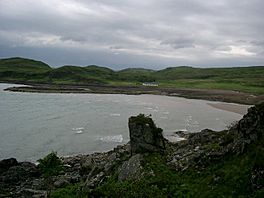
Sandaig Bay on a wet night.
|
|
| Location | NG726016 |
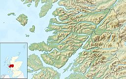
| Coordinates | 57°02′42″N 5°45′53″W / 57.045133°N 5.764828°W |
| Type | Sea loch bay |
| Primary inflows | Sandaig Burn |
| Ocean/sea sources | Atlantic Ocean |
| Islands | Eilean Mòr, Fraoch Eilean, Sgeir nan Eun |
Sandaig Bay is a beautiful coastal area, like a curved part of the coastline, found in Scotland. It's located on the northwest side of the Knoydart peninsula. This bay faces the Sound of Sleat, which is a narrow stretch of sea. Sandaig Bay is also part of a larger sea inlet called Loch Nevis.
Exploring Sandaig Bay's Location
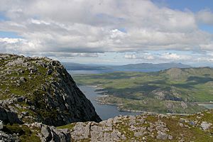
Just south of Sandaig Bay, you'll find another sea loch called Loch Hourn. This loch helps separate two peninsulas: Kintail to the north and Knoydart to the south.
Looking west from Sandaig Bay, you can see the Sound of Sleat. This view is dominated by two tall mountains on the Isle of Skye. These are Beinn na Seamraig, which is about 561 meters (1,841 feet) high, and Ben Aslak, which is about 610 meters (2,001 feet) high.
Further north, you can spot two more peaks on the Isle of Skye. The closest and highest peak in northern Skye is Sgùrr na Coinnich, standing at about 739 meters (2,425 feet). A bit further away is Beinn na Caillich, which is around 732 meters (2,402 feet) tall.
Features of Sandaig Bay
Sandaig Bay is well-known for the sandy areas that have formed at its edge. In the northern part of the bay, there used to be a Roman Catholic chapel.
On the eastern side of the bay, there are several rocky islands. These islands are located about two cable lengths (which is about 370 meters or 1,200 feet) from the shore, right at the entrance to the bay. The larger islands are named Eilean Mòr and Fraoch Eilean. There's also a smaller island called Sgeir nan Eun. Because of these islands and its open western side, the bay is not considered a very safe place for boats to anchor.
 | Frances Mary Albrier |
 | Whitney Young |
 | Muhammad Ali |


