Sandcut, Indiana facts for kids
Quick facts for kids
Sandcut, Indiana
|
|
|---|---|
| Nickname(s):
Meltonville
|
|

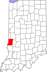
Vigo County's location in Indiana
|
|
| Country | United States |
| State | Indiana |
| County | Vigo |
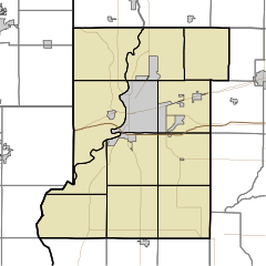
| Township | Otter Creek |
| Elevation | 525 ft (160 m) |
| Time zone | UTC-5 (Eastern (EST)) |
| • Summer (DST) | UTC-4 (EDT) |
| ZIP code |
47805
|
| Area code(s) | 812, 930 |
| GNIS feature ID | 442993 |
Sandcut is a small place in Indiana, a state in the United States. It's called an "unincorporated community" because it doesn't have its own local government like a city or town. Sandcut is found in Vigo County, specifically in Otter Creek Township. It's also part of the larger Terre Haute metropolitan area, which means it's near the city of Terre Haute. A small stream called Little Gundy Creek flows nearby. Sandcut even has its own volunteer fire department, helping to keep everyone safe.
The Story of Sandcut
Sandcut started in 1927. It got its name because the soil in the area was very sandy.
Where is Sandcut Located?
Sandcut is located where two roads meet: Rio Grande Avenue and Rosedale Road. You can find it at these coordinates: 39°33′53″N 87°19′25″W / 39.56472°N 87.32361°W.
Black History Month on Kiddle
African-American Labor Activists
 | William Lucy |
 | Charles Hayes |
 | Cleveland Robinson |

All content from Kiddle encyclopedia articles (including the article images and facts) can be freely used under Attribution-ShareAlike license, unless stated otherwise. Cite this article:
Sandcut, Indiana Facts for Kids. Kiddle Encyclopedia.

