
Santa Brígida, Las Palmas facts for kids
Quick facts for kids
Santa Brígida
Sataute
|
|||
|---|---|---|---|
|
Municipality
|
|||

Santa Brígida
|
|||
|
|||
| Motto(s):
"Por España y por la Fe vencimos al Holandés"
|
|||

Municipal location in Gran Canaria
|
|||

Santa Brígida
Location in Province of Las Palmas

Santa Brígida
Location in Canary Islands

Santa Brígida
Location in Spain, Canary Islands
|
|||
| Country | |||
| Autonomous Community | |||
| Province | Las Palmas | ||
| Island | Gran Canaria | ||
| Area | |||
| • Total | 23.81 km2 (9.19 sq mi) | ||
| Elevation
(AMSL)
|
520 m (1,710 ft) | ||
| Population
(2018)
|
|||
| • Total | 18,314 | ||
| • Density | 769.17/km2 (1,992.1/sq mi) | ||
| Demonym(s) | Satauteño/ña | ||
| Time zone | UTC+0 (CET) | ||
| • Summer (DST) | UTC+1 (CEST (GMT +1)) | ||
| Postal code |
35300
|
||
| Area code(s) | +34 (Spain) + 928 (Las Palmas) | ||
| Website | www.santabrigida.es | ||


Santa Brígida is a town located in the northeastern part of Gran Canaria island. This island is part of the Canary Islands in Spain. Santa Brígida is a municipality, which means it's like a local government area.
The town is quite close to Las Palmas, which is a bigger city. Santa Brígida is even considered part of Las Palmas's urban area. In 2013, about 18,791 people lived here. The total area of the municipality is about 23.81 square kilometers.
Contents
Exploring Santa Brígida: Fun Places to Visit
Santa Brígida has some amazing natural and historical spots that are great to explore.
Discovering Bandama Caldera
One of the most exciting places is the Bandama Caldera. A caldera is a large, bowl-shaped hollow that forms when the ground collapses after a volcanic eruption. This one is part of the Tafira Protected Landscape.
The highest point around the caldera is called Pico de Bandama, which is 569 meters (about 1,867 feet) above sea level. The caldera itself is about 1,000 meters (about 3,280 feet) wide and 200 meters (about 656 feet) deep. You can hike down to the bottom, which takes about half an hour. Down there, you'll see lots of volcanic ash in different colors. You can also find unique plants that only grow in the Canary Islands.
Ancient History: Archaeological Sites
Santa Brígida is also rich in history, especially in the valleys of La Angostura and Las Meleguinas. Here, you can find many signs of the ancient people who lived on the Canary Islands, called Aboriginal Canarians. Because of these important discoveries, the area has been declared a Cultural Site.
You can see groups of caves carved into the rock, places where they stored food (silos), and old pathways. At a site called El Tope, discovered in 1988, experts found signs of an ancient burial mound. They also found pottery and interesting pintaderas, which are stamps used for decoration. Some very old writings, called Libyan-Berber inscriptions, and special pots were also found. These are now kept in the Museo Canario museum.
In the same area, on the side of the volcano, there's a place called Cueva de Los Frailes. This is a group of 37 caves that were found in 1933.
Panorama
.jpg)
.jpg)
.jpg)
Gallery
-
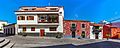
Santa Brígida
-
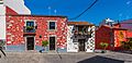
Santa Brígida
-
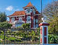
Santa Brígida
.jpg)
.jpg)

See also
 In Spanish: Santa Brígida (Gran Canaria) para niños
