Santa Rita, Venezuela facts for kids
Quick facts for kids
Santa Rita
|
|||
|---|---|---|---|
| Valle de Santa Rita de Cascia | |||
|
|||
| Country | |||
| State | Aragua | ||
| Municipality | Francisco Linares Alcántara Municipality | ||
| City Established | December 16, 1997 | ||
| Elevation | 435 m (1,427 ft) | ||
| Population
(2001)
|
|||
| • Total | 134,233 | ||
| • Demonym | Santaricense/a | ||
| Time zone | UTC−4 (VST) | ||
| Postal code |
2103
|
||
| Area code(s) | 0243 | ||
| Climate | Aw | ||
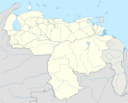
Santa Rita is a city located in the state of Aragua, Venezuela. It is the main town, also known as the shire town, of the Francisco Linares Alcántara Municipality. Santa Rita is part of the larger city area of Maracay.
The city sits 435 meters (about 1,427 feet) above sea level. It is located in the area that drains into Lake Valencia (Venezuela). To the north, Santa Rita is bordered by the Caño Colorado stream and the Caracas-Valencia Highway. To the south, it is bordered by the Turmero River. In 2023, Santa Rita had about 149,158 people living there.
Understanding Santa Rita's Landscape
The city of Santa Rita is found in a natural area called the "Valencia Lake Depression." This means it's in a lower, flatter part of the land around Lake Valencia. Specifically, it's in the central plain of this depression.
The land in Santa Rita is mostly flat. It has a very slight slope that goes down towards the southwest. The height of the land is about 428 meters (1,404 feet) above sea level.
Santa Rita's Climate and Weather
The climate in Santa Rita is a dry pre-mountainous type. This means it's a dry climate that is transitioning to a dry tropical climate. It's influenced by being near mountains but also having warm, dry conditions.
The average temperature in Santa Rita throughout the year is about 25 °C (77 °F). The city also receives an average of 902 millimeters (about 35.5 inches) of rain each year. This amount of rain is called precipitation.
See also

- In Spanish: Santa Rita (Aragua) para niños
 | DeHart Hubbard |
 | Wilma Rudolph |
 | Jesse Owens |
 | Jackie Joyner-Kersee |
 | Major Taylor |


