
Santa Rosa District, Turrialba facts for kids
Santa Rosa is a special area, called a district, located in the Turrialba region. It's part of the Cartago province in the beautiful country of Costa Rica.
Quick facts for kids
Santa Rosa
|
|
|---|---|
|
District
|
|

Santa Rosa
Location in Costa Rica
|
|
| Country | |
| Province | Cartago |
| Canton | Turrialba |
| Creation | 11 June 1968 |
| Area | |
| • Total | 22.29 km2 (8.61 sq mi) |
| Elevation | 810 m (2,660 ft) |
| Population
(2011)
|
|
| • Total | 5,232 |
| • Density | 234.72/km2 (607.93/sq mi) |
| Time zone | UTC−06:00 |
| Postal code |
30509
|
Contents
History of Santa Rosa
Santa Rosa was officially created on June 11, 1968. This happened through a special government decision called "Decreto Ejecutivo 20." Before this, Santa Rosa was part of the Turrialba area.
Geography and Location
Santa Rosa covers an area of about 22.29 square kilometers. To give you an idea, that's roughly the size of 2,229 football fields! The district is located at an elevation of 810 meters above sea level. This means it's quite high up, which can affect its climate and scenery.
People and Population
| Historical population | |||
|---|---|---|---|
| Census | Pop. | %± | |
| 1973 | 5,551 | — | |
| 1984 | 3,874 | −30.2% | |
| 2000 | 4,759 | 22.8% | |
| 2011 | 5,232 | 9.9% | |
|
Instituto Nacional de Estadística y Censos |
|||
In 2011, a count of all the people living in Costa Rica was done. This is called a census. According to the 2011 census, Santa Rosa had a population of 5,232 people.
Getting Around Santa Rosa
Road Connections
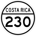
The district of Santa Rosa has important roads that help people travel. One of the main roads that goes through the area is:
- National Route 230
Images for kids
-
A symbol for National Route 230
-

A friendly robot icon


See also
In Spanish: Santa Rosa de Turrialba para niños
