Schulter, Oklahoma facts for kids
Quick facts for kids
Schulter, Oklahoma
|
|
|---|---|

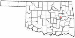
Location of Schulter, Oklahoma
|
|
| Country | United States |
| State | Oklahoma |
| County | Okmulgee |
| Area | |
| • Total | 0.85 sq mi (2.20 km2) |
| • Land | 0.85 sq mi (2.20 km2) |
| • Water | 0.00 sq mi (0.00 km2) |
| Elevation | 699 ft (213 m) |
| Population
(2020)
|
|
| • Total | 422 |
| • Density | 497.06/sq mi (192.01/km2) |
| Time zone | UTC-6 (Central (CST)) |
| • Summer (DST) | UTC-5 (CDT) |
| ZIP code |
74460
|
| Area code(s) | 539/918 |
| FIPS code | 40-65900 |
| GNIS feature ID | 2413265 |
Schulter is a small town located in Okmulgee County, Oklahoma, in the United States. According to the 2020 census, 422 people lived there.
Contents
History of Schulter
Schulter is found in Okmulgee County. It is about eight miles south of Okmulgee and six miles north of Henryetta. The town is close to U.S. Route 75 and U.S. Route 62.
Early Days and Name
The town might have first been called Winchell. In 1900, a railway line was built through the area. This line was part of the St. Louis, Oklahoma and Southern Railway. It later became known as the St. Louis–San Francisco Railway, or Frisco.
A post office was opened in August 1903. It was named after Matt Schulter. He was said to be a person living in St. Louis, Missouri.
Coal Mining and Growth
In the early days, coal mining was a very important business in the Schulter area. Many people from different countries in Europe moved here to work in the mines.
Around 1909, Schulter was a small but busy town. It had offices for three coal companies. There was also phone service, a school, a general store, and even a pool hall. About 200 people lived in Schulter at that time.
Oil and Population Peak
Later, the town also grew because of oil. People explored for oil, produced it, and refined it nearby. This helped the town's economy.
Schulter's population was probably highest around 1930. About 650 people lived there then. The town officially became an incorporated town on May 5, 1998. This means it became an official local government.
Geography of Schulter
Schulter is located between two other towns. Okmulgee is to the north, and Henryetta is to the south.
The main roads, U.S. Route 75 and U.S. Route 62, both go through Schulter. These roads run north and south. East of the town, you can find Lake Eufaula.
The United States Census Bureau says that Schulter covers about 0.9 square miles (2.2 square kilometers). All of this area is land.
Population and People
| Historical population | |||
|---|---|---|---|
| Census | Pop. | %± | |
| 2000 | 600 | — | |
| 2010 | 509 | −15.2% | |
| 2020 | 422 | −17.1% | |
| U.S. Decennial Census | |||
In the year 2000, there were 600 people living in Schulter. There were 234 households, which are groups of people living in one home. Out of these, 169 were families.
The population density was about 681 people per square mile. This means that for every square mile, there were about 681 people living there. There were also 253 housing units, like houses or apartments.
Most of the people in Schulter were White (84.50%). Some were Native American (8.33%), and others were from two or more races (7.17%). About 1.67% of the population was Hispanic or Latino.
Households and Age Groups
In 2000, about 35% of households had children under 18 living with them. More than half (57.3%) were married couples. Some households (12%) had a female head with no husband present. About 27.4% were not families.
Almost a quarter (24.8%) of all households were single individuals. About 12.8% of households had someone living alone who was 65 years old or older. On average, there were 2.56 people in each household and 3.04 people in each family.
The town's population was spread out by age. About 26.8% were under 18 years old. About 8.5% were between 18 and 24. People aged 25 to 44 made up 24.2% of the population. Those aged 45 to 64 were 27.7%. Finally, 12.8% of the people were 65 years or older. The average age in Schulter was 39 years.
See also
 In Spanish: Schulter (Oklahoma) para niños

