
Scranton, Arkansas facts for kids
Quick facts for kids
Scranton, Arkansas
|
|
|---|---|

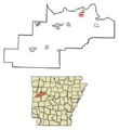
Location in Logan County, Arkansas
|
|
| Country | United States |
| State | Arkansas |
| County | Logan |
| Area | |
| • Total | 0.51 sq mi (1.31 km2) |
| • Land | 0.51 sq mi (1.31 km2) |
| • Water | 0.00 sq mi (0.00 km2) |
| Elevation | 377 ft (115 m) |
| Population
(2020)
|
|
| • Total | 245 |
| • Density | 484.19/sq mi (186.87/km2) |
| Time zone | UTC-6 (Central (CST)) |
| • Summer (DST) | UTC-5 (CDT) |
| ZIP code |
72863
|
| Area code(s) | 479 |
| FIPS code | 05-62960 |
| GNIS feature ID | 2405435 |
Scranton is a small city in Logan County, Arkansas, in the United States. It is named after the city of Scranton, Pennsylvania. In 2020, about 245 people lived there.
Contents
Where is Scranton?
Scranton is located in the northeastern part of Logan County. It covers a total area of about 0.5 square miles (1.3 square kilometers), and all of it is land.
Main Roads in Scranton
Arkansas Highway 197 is the main street in Scranton. It goes southwest about 10 miles to Subiaco. Another road, Arkansas Highway 109, also passes through Scranton as 5th Street. This road goes north about 7 miles to U.S. Route 64 near Clarksville. It also goes south about 5 miles to Midway.
How Many People Live in Scranton?
| Historical population | |||
|---|---|---|---|
| Census | Pop. | %± | |
| 1920 | 400 | — | |
| 1930 | 332 | −17.0% | |
| 1940 | 322 | −3.0% | |
| 1950 | 283 | −12.1% | |
| 1960 | 229 | −19.1% | |
| 1970 | 222 | −3.1% | |
| 1980 | 244 | 9.9% | |
| 1990 | 218 | −10.7% | |
| 2000 | 222 | 1.8% | |
| 2010 | 224 | 0.9% | |
| 2020 | 245 | 9.4% | |
| U.S. Decennial Census | |||
In 2000, there were 222 people living in Scranton. These people made up 90 households and 66 families. The city had about 447 people per square mile.
Who Lives in Scranton?
Most people in Scranton are White (about 97%). A small number are Black or African American (less than 1%), and some are from two or more races (about 1.8%).
About 31% of the households had children under 18 living with them. More than half of the households (55.6%) were married couples. About 23% of all households were single people living alone. Many older people (65 or older) also lived by themselves.
The average age of people in Scranton was 39 years old. About 24% of the population was under 18, and 18.5% were 65 or older. For every 100 females, there were about 96 males.
Education in Scranton
Students in Scranton and nearby areas go to public schools run by the Scranton School District. This district helps over 400 students. It also has more than 70 teachers and staff.
Schools in Scranton
The Scranton School District has two schools:
- Scranton Elementary School: This school teaches students from kindergarten up to 6th grade.
- Scranton High School: This school is for older students, from 7th grade through 12th grade.
Images for kids
-
Map showing Scranton's location in Logan County, Arkansas.
See also
 In Spanish: Scranton (Arkansas) para niños
