Seboeis Lake facts for kids
Quick facts for kids Seboeis Lake |
|
|---|---|
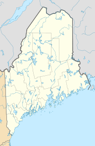
| Location | Piscataquis County, Maine |
| Coordinates | 45°27′22″N 68°52′23″W / 45.4560611°N 68.8730841°W |
| Lake type | Reservoir |
| Primary outflows | West Branch Seboeis Stream |
| Basin countries | United States |
| Max. length | 6.7 mi (10.8 km) |
| Max. width | 1.5 mi (2.4 km) |
| Surface area | 4,913 acres (1,988 ha) |
| Max. depth | 69 feet (21 m) |
| Water volume | 76,905 acre⋅ft (94,861,000 m3) |
| Surface elevation | 436 ft (133 m) |
Seboeis Lake is a beautiful body of water located in Piscataquis County, Maine, USA. It stretches from Lake View Plantation north into a wilder area. The lake has rocky edges and soft sandy beaches. You can also find several islands covered with tall pine trees.
Many small streams flow into the lake, bringing fresh water. These include Dean Brook, Jordan Brook, and West Seboeis Stream. Bear Brook and Northwest Pond also add water to the lake. One important stream, West Branch Seboeis Stream, flows out of the lake. This stream eventually connects to the Piscataquis River, which then joins the larger Penobscot River.
Fishing at Seboeis Lake
If you love fishing, Seboeis Lake is a great spot! You can get your boat into the water from a special area near West Seboeis. This area is easy to reach from Maine State Route 11.
The lake is a good home for several types of fish. You might catch white perch, chain pickerel, or smallmouth bass. Sometimes, brook trout swim into the lake from the smaller streams that feed it.
There is a dam where water flows out of the lake. This dam helps control the water level. It also stops certain fish, like salmon, from swimming up into the lake from the ocean to lay their eggs.


