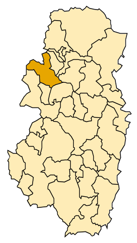
Seira, Aragon facts for kids
Quick facts for kids
Seira
|
|
|---|---|
| Country | Spain |
| Autonomous community | Aragon |
| Province | Huesca |
| Comarca | Ribagorza (comarca) |
| Area | |
| • Total | 69.4 km2 (26.8 sq mi) |
| Elevation | 810 m (2,660 ft) |
| Population
(2018)
|
|
| • Total | 150 |
| Demonym(s) | Seirano, Seirana |
| Time zone | UTC+1 (CET) |
| • Summer (DST) | UTC+2 (CEST) |
Seira is a small town located in the Ribagorza region. This area is part of the province of Huesca, which is in Aragon, Spain. In 2018, about 150 people lived in Seira. The town's postal code is 22463.
Seira is found on the left side of the Ésera River. It is in a very mountainous area, which means it has lots of hills and peaks around it.
Contents
Welcome to Seira!
Seira is a charming little municipality in the beautiful country of Spain. It's known for its quiet, natural surroundings. The town is nestled among mountains, offering amazing views and a peaceful environment.
Where is Seira Located?
Seira is in the northeastern part of Spain. It's specifically in the Aragon region, which is one of Spain's 17 autonomous communities. Think of an autonomous community like a large state or region with its own government. Within Aragon, Seira is in the province of Huesca.
Seira's Mountain Home
The town sits right next to the Ésera River. This river flows through a valley surrounded by tall mountains. Being in such a mountainous spot means the town is high up. Its elevation is about 810 meters (around 2,657 feet) above sea level. This high location often means cooler temperatures and stunning natural scenery.
How Many People Live in Seira?
Seira is a very small community. In 2018, the official count showed that only 150 people lived there. This makes it one of the smaller towns in the Huesca province. People who live in Seira are called "Seirano" (for males) or "Seirana" (for females).
What is a Municipality?
You might see Seira called a "municipality." A municipality is like a local government area. It's a town or city and the land around it, all governed by one local council. Seira, even though it's small, has its own local government to manage things like roads and services for its residents.
See Also
 In Spanish: Seira (Huesca) para niños


