Shannondale, Indiana facts for kids
Quick facts for kids
Shannondale, Indiana
|
|
|---|---|
| Country | United States |
| State | Indiana |
| County | Montgomery, Boone |
| Township | Franklin, Jefferson |
| Elevation | 860 ft (260 m) |
| Time zone | UTC-5 (Eastern (EST)) |
| • Summer (DST) | UTC-4 (EDT) |
| ZIP code |
46071
|
| Area code(s) | 765 |
| FIPS code | 18-68994 |
| GNIS feature ID | 443286 |
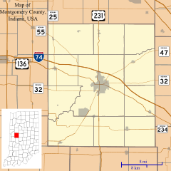
Shannondale is a small place in the U.S. state of Indiana. It is called an unincorporated community. This means it's a group of homes and businesses that isn't officially a town or city. Shannondale is located across two different areas: Montgomery County and Boone County.
History of Shannondale
Shannondale was first planned out in 1851. Two people named Isaiah Lame and George Woods created the original map for the community.
Early Services in Shannondale
A man named Nathan Shannon was one of the first people to run the local post office. A post office is where people send and receive mail. The post office in Shannondale opened in 1852. It helped people living there send letters and packages. However, the post office eventually closed its doors in 1909.
Black History Month on Kiddle
Renowned African-American Artists:
 | Selma Burke |
 | Pauline Powell Burns |
 | Frederick J. Brown |
 | Robert Blackburn |

All content from Kiddle encyclopedia articles (including the article images and facts) can be freely used under Attribution-ShareAlike license, unless stated otherwise. Cite this article:
Shannondale, Indiana Facts for Kids. Kiddle Encyclopedia.

