Siem Reap Province facts for kids
Quick facts for kids
Siem Reap Province
សៀមរាប
|
|
|---|---|
|
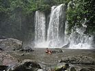
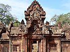
Clockwise from top: Cambodian Cultural Village, Banteay Srei, Angkor Thom, Ta Prohm, Tonlé Sap, Phnom Kulen, Angkor Wat
|
|
| Nickname(s):
Gateway to Angkor
|
|

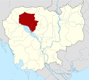
Map of Cambodia highlighting Siem Reap
|
|
| Country | |
| Settled | 802 |
| Provincial status | 23 December 1907 |
| Capital | Siem Reap Municipality |
| Area | |
| • Total | 10,299 km2 (3,976 sq mi) |
| Population
(2019)
|
|
| • Total | |
| • Density | 98/km2 (250/sq mi) |
| Time zone | UTC+7 (ICT) |
| Dialing code | 087629502+855 |
| ISO 3166 code | KH-17 |
| Districts | 12 |
| Communes | 100 |
| Villages | 907 |
Siem Reap is a province located in Cambodia. Its main city and capital is also called Siem Reap.
This province is a very important part of the Tonle Sap Biosphere Reserve. It is famous for being home to Angkor and the amazing Angkor Wat temple ruins. These ruins are so special that they are a UNESCO World Heritage Site. You can also find Phnom Kulen National Park within the province.
What Are the Parts of Siem Reap Province?
Siem Reap province is divided into 12 smaller areas called districts. Think of them like different neighborhoods or towns within the larger province.
Districts of Siem Reap
- Angkor Chum
- Angkor Thom
- Banteay Srei
- Chi Kraeng
- Kralanh
- Puok
- Prasat Bakong
- Siem Reap Municipality
- Sout Nikom
- Srei Snam
- Svay Leu
- Varin
Images for kids
See Also
 In Spanish: Provincia de Siem Riep para niños
Black History Month on Kiddle
Famous African-American Artists:
 | Emma Amos |
 | Edward Mitchell Bannister |
 | Larry D. Alexander |
 | Ernie Barnes |

All content from Kiddle encyclopedia articles (including the article images and facts) can be freely used under Attribution-ShareAlike license, unless stated otherwise. Cite this article:
Siem Reap Province Facts for Kids. Kiddle Encyclopedia.


