Sierra del Mico facts for kids
Quick facts for kids Sierra del Mico |
|
|---|---|
| Montañas del Mico | |
 |
|
| Highest point | |
| Peak | Cerro San Gil |
| Elevation | 1,267 m (4,157 ft) |
| Dimensions | |
| Length | 60 km (37 mi) |
| Geography | |
| Country | Guatemala |
| State/Province | Izabal |
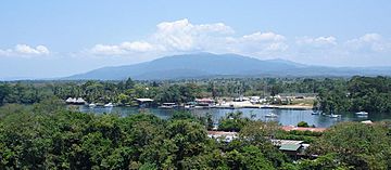
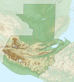
The Sierra del Mico is a cool mountain range in Guatemala. It's also known as the Montañas del Mico. This mountain range is found in the northeastern part of the country. It's not far from a city called Puerto Barrios.
Contents
What is the Sierra del Mico?
The Sierra del Mico is a smaller mountain range. It stretches for about 60 kilometers (that's about 37 miles). It's located northeast of another mountain range, the Sierra de las Minas.
Where is it Located?
This mountain range is in the Izabal department of Guatemala. This area is known for its beautiful nature. The mountains gently slope down towards the east. They eventually meet the warm waters of the Caribbean Sea.
Highest Point of the Range
The tallest part of the Sierra del Mico is a peak called Cerro San Gil. This mountain stands at 1,267 meters (or 4,157 feet) high. Imagine standing on top and looking out at the amazing views!
Importance of Mountain Ranges
Mountain ranges like the Sierra del Mico are very important. They play a big role in the environment. They help shape the weather and create different habitats.
How Mountains Affect Weather
Mountains can block winds and clouds. This often causes rain to fall on one side of the mountain. The other side might stay much drier. This creates different climates in nearby areas.
Mountains and Water
Mountains are like giant sponges. They collect rainwater and snow. This water then flows down in rivers and streams. These waterways provide fresh water for people and animals. The Sierra del Mico helps feed rivers that flow into the Caribbean Sea.
Home to Wildlife
Mountain ranges are also home to many different plants and animals. They provide unique places for them to live. The forests and slopes of the Sierra del Mico are likely filled with interesting creatures.
Exploring the Area
The region around the Sierra del Mico is a great place to explore. It offers chances to see nature up close. You can find beautiful landscapes and learn about the local environment.
Nearby Places to See
- Puerto Barrios: This is a port city near the mountains. It's a busy place where ships come and go.
- Caribbean Sea: The eastern side of the mountains meets the sea. This means you can find beaches and coastal areas nearby.
See also
In Spanish: Sierra del Mico para niños
 | Georgia Louise Harris Brown |
 | Julian Abele |
 | Norma Merrick Sklarek |
 | William Sidney Pittman |


