Sisson-South Whitney Historic District facts for kids
Quick facts for kids |
|
|
Sisson-South Whitney District
|
|
 |
|
| Location | Roughly bounded by West Blvd., S. Whitney St., Farmington & Sisson Aves., Hartford, Connecticut |
|---|---|
| Built | 1865 |
| NRHP reference No. | 13000526 |
| Added to NRHP | July 24, 2013 |
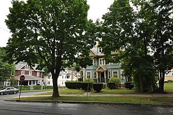
The Sisson-South Whitney Historic District is a special neighborhood in Hartford, Connecticut. It's located in the city's West End area. This district was mostly built between 1890 and 1930. It became a "streetcar suburb," which means people could easily travel to and from the city center using streetcars.
The district includes many different types of homes and businesses. These buildings show how the area grew over time. The Sisson-South Whitney Historic District was added to the National Register of Historic Places in 2013. This means it's recognized as an important historical place.
Contents
Discovering the Sisson-South Whitney District
This historic area is roughly bordered by Farmington Avenue, South Whitney Street, West Boulevard, and Sisson Avenue. It's a great example of how cities changed in the late 1800s and early 1900s.
How Hartford's West End Grew
Before 1870, the West End of Hartford was mostly farmland. This area stretched from the Park River to the city's western edge. But things started to change quickly.
By the early 1890s, streetcars were a popular way to get around. Hartford's streetcar lines reached into this farmland. Developers bought the land, divided it into smaller plots, and started building.
Building a New Neighborhood
Farmington Avenue became a busy street with shops and services for the new residents. Homes were built on the streets both north and south of Farmington Avenue. South Whitney Street was created in 1897, and Sisson Avenue followed in 1900.
Almost one-third of the buildings in the district were built between 1890 and 1909. Construction continued at a similar speed for the next twenty years. This rapid growth created the neighborhood we see today.
Homes and Architecture in the District
The historic district covers a large area. It runs along Farmington Avenue between South Whitney and Sisson Avenue. It also extends along South Whitney, Sisson Avenue, and Evergreen Avenue, reaching West Boulevard.
Most of the buildings are two-story homes. The majority of these houses are made of wood. They show many different architectural styles that were popular at the time. These styles are often called "revival styles" because they brought back older designs.
The homes are usually on small lots. They have similar distances from the street and are about the same size. This gives the streets a very organized and unified look.
 | William Lucy |
 | Charles Hayes |
 | Cleveland Robinson |


