Sohag Governorate facts for kids
Quick facts for kids
Sohag Governorate
|
|||
|---|---|---|---|
|
|||

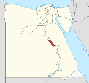
Sohag Governorate on the map of Egypt
|
|||
| Country | |||
| Seat | Sohag (capital) | ||
| Area | |||
| • Total | 1,547 km2 (597 sq mi) | ||
| Population
(January 2018)
|
|||
| • Total | 5,063,000 | ||
| • Density | 3,272.8/km2 (8,476/sq mi) | ||
| Time zone | UTC+2 (EET) | ||
Sohag Governorate is a special area in Egypt. Think of a governorate like a state or a large region. It is located in the southern part of Egypt, along the Nile River. The main city and capital of Sohag Governorate is Sohag. This city became the capital in 1960. Before that, the capital was a city called Girga, and the whole area was known as Girga Governorate.
Cities and Towns in Sohag
Sohag Governorate is home to many interesting cities and towns. Each one has its own history and importance in the region. Here are some of the main ones:
- Akhmim
- Dar El Salam
- El Balyana
- El Mansha
- El Maragha
- El Usayrat
- Girga
- Juhayna
- Sakulta
- Sohag
- Tahta
- Tima
Important Historical Sites
Sohag Governorate is rich in ancient history. It has many important sites that tell us about Egypt's past. These places are often visited by people who want to learn about old civilizations.
- Abydos El Balyana
- Apollonos Polis
- Beit Khallaf
- El Hawawish
- El Salamuni
- Gabal El Haridi
- Hut-Repyt
- Kom Ishqaw
- Tjebu
- Red Monastery
- White Monastery
See also
 In Spanish: Gobernación de Suhag para niños
 | John T. Biggers |
 | Thomas Blackshear |
 | Mark Bradford |
 | Beverly Buchanan |


