South Amana, Iowa facts for kids
Quick facts for kids
South Amana, Iowa
|
|
|---|---|
| Country | United States |
| State | Iowa |
| County | Iowa |
| Area | |
| • Total | 1.39 sq mi (3.59 km2) |
| • Land | 1.39 sq mi (3.59 km2) |
| • Water | 0.00 sq mi (0.00 km2) |
| Elevation | 778 ft (237 m) |
| Population
(2020)
|
|
| • Total | 165 |
| • Density | 119.13/sq mi (46.00/km2) |
| Time zone | UTC-6 (Central (CST)) |
| • Summer (DST) | UTC-5 (CDT) |
| ZIP code |
52334
|
| FIPS code | 19-73965 |
| GNIS feature ID | 461756 |
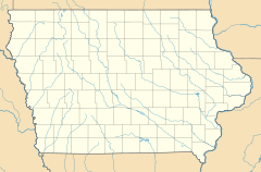
South Amana is a small community in Iowa County, Iowa, United States. It is known as an unincorporated community and a census-designated place (CDP). This means it is a group of homes and businesses that are not officially part of a city or town, but the government counts its population.
South Amana is one of the "seven villages" that make up the Amana Colonies. These colonies are famous for their unique history and culture. In 2010, about 159 people lived in South Amana. By 2020, the population had grown slightly to 165 people.
This community is located along U.S. Route 6, which is a major road. It lies east of Marengo, which is the main town of Iowa County. South Amana is about 778 feet (237 meters) above sea level. It has its own post office with the ZIP code 52334. This post office first opened a long time ago, on June 19, 1874. In the past, South Amana was an important place for shipping goods by train on the Chicago, Rock Island and Pacific Railroad.
How Many People Live in South Amana?
The number of people living in South Amana has been counted over the years. This is called a census.
| Historical population | |||
|---|---|---|---|
| Census | Pop. | %± | |
| 2020 | 165 | — | |
| U.S. Decennial Census | |||
- In 2010, the population was 159 people.
- In 2020, the population increased to 165 people.
See also
 In Spanish: South Amana (Iowa) para niños
 | Madam C. J. Walker |
 | Janet Emerson Bashen |
 | Annie Turnbo Malone |
 | Maggie L. Walker |


