South Waziristan facts for kids
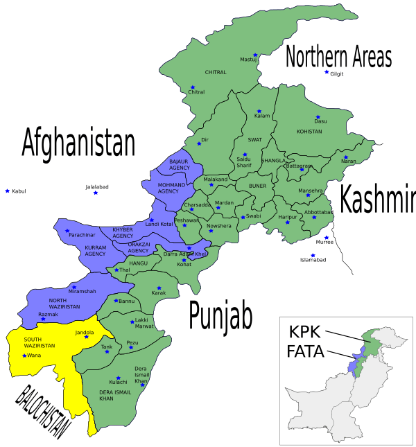
South Waziristan (which is جنوبی وزیرستان in Pashto) is a mountainous area in the northwest of Pakistan. It shares a border with Afghanistan. This region covers about 11,585 square kilometers (4,473 square miles).
It is located west and southwest of the city of Peshawar. The Tochi River is to its north, and the Gomal River is to its south. South Waziristan was once part of Pakistan's Federally Administered Tribal Areas (FATA). The Khyber Pakhtunkhwa province is just to its east.
About South Waziristan
South Waziristan is known for its rugged mountains and tribal communities. The people living here are mainly from the Pashtun tribes. They have a strong sense of independence and unique traditions.
Geography and Location
This region is very hilly and has many valleys. Its location near the border of Afghanistan makes it an important area. The climate can be extreme, with very hot summers and cold winters.
History of the Region
For a long time, South Waziristan was an independent tribal territory. This was from 1893 onwards. It stayed outside the control of both the British Empire and Afghanistan.
The local tribes sometimes raided areas that were under British rule. Because of this, the British often sent military groups to the region. These actions happened many times between 1860 and 1945. They were meant to stop the raids and keep peace.
South Waziristan officially became a part of Pakistan in 1947. This happened when Pakistan gained its independence.
See also
 In Spanish: Waziristán del Sur para niños
 | Madam C. J. Walker |
 | Janet Emerson Bashen |
 | Annie Turnbo Malone |
 | Maggie L. Walker |


