Southwood, Indiana facts for kids
Quick facts for kids
Southwood, Indiana
|
|
|---|---|

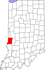
Vigo County's location in Indiana
|
|
| Country | United States |
| State | Indiana |
| County | Vigo |
| Township | Honey Creek |
| Elevation | 495 ft (151 m) |
| Time zone | UTC-5 (Eastern (EST)) |
| • Summer (DST) | UTC-4 (EDT) |
| ZIP code |
47802
|
| Area code(s) | 812, 930 |
| GNIS feature ID | 443897 |
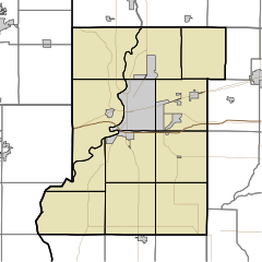
Southwood is a small place in Indiana, a state in the United States. It's known as an unincorporated community. This means it doesn't have its own local government like a city or town. Instead, it's part of a larger area called Honey Creek Township within Vigo County.
Southwood is also part of the Terre Haute metropolitan area. A metropolitan area includes a big city, like Terre Haute, and all the smaller towns and communities around it. People in Southwood often use services and businesses found in Terre Haute.
Where is Southwood Located?
Southwood is found in the western part of Indiana. Its exact spot on a map is at coordinates 39 degrees 24 minutes 11 seconds North and 87 degrees 24 minutes 6 seconds West. The land where Southwood sits is about 495 feet (or 151 meters) above sea level.
 | Emma Amos |
 | Edward Mitchell Bannister |
 | Larry D. Alexander |
 | Ernie Barnes |


