St. Catharine, Missouri facts for kids
Quick facts for kids
St. Catharine, Missouri
|
|
|---|---|

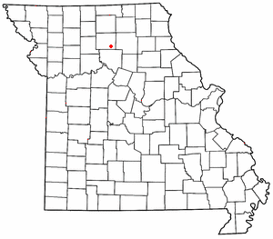
Location of St. Catharine in Missouri
|
|
| Country | United States |
| State | Missouri |
| County | Linn |
| Area | |
| • Total | 0.74 sq mi (1.91 km2) |
| • Land | 0.73 sq mi (1.90 km2) |
| • Water | 0.00 sq mi (0.01 km2) |
| Elevation | 830 ft (250 m) |
| Population
(2020)
|
|
| • Total | 78 |
| • Density | 106.41/sq mi (41.08/km2) |
| FIPS code | 29-64046 |
| GNIS feature ID | 2587111 |
St. Catharine is a small place in Missouri, United States. It is known as an "unincorporated community." This means it's a group of homes and businesses that isn't officially a city or town with its own local government. It's also a "census-designated place," which means the government counts the people living there for official records.
St. Catharine is located in the southeastern part of Linn County. You can find it about four miles east of a larger town called Brookfield. It sits right along Missouri Route 11, a main road in the area. A railroad track, once part of the Chicago, Burlington and Quincy Railroad, runs just south of the community.
History of St. Catharine
St. Catharine was started a long time ago, in 1856. It has an interesting story about how it got its name! Many people might think it was named after a famous saint, Catherine of Alexandria. But actually, it was named by William Elliot for his wife, Mrs. Catherine Elliot.
A post office was opened in St. Catharine in 1859. This was a very important place for people to send and receive letters and packages. The post office served the community for many years, finally closing down in 1993.
Who Lives in St. Catharine?
The number of people living in St. Catharine is counted regularly by the government. This count is called a census. According to the 2020 census, there were 78 people living in St. Catharine. This makes it a very small and quiet community.
 | Audre Lorde |
 | John Berry Meachum |
 | Ferdinand Lee Barnett |

