St. Mary's Bay, Newfoundland and Labrador facts for kids
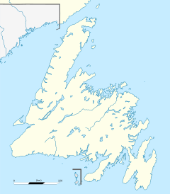
St. Mary's Bay is a large bay in Newfoundland, Canada. It's one of many bays that act like local areas, similar to how counties work in other places. This bay is the most southern and eastern of Newfoundland's main bays.
It sits on the southern coast of the Avalon Peninsula. This area is very important to Irish Newfoundlanders, who are people of Irish heritage living in Newfoundland. Their families came from places like County Waterford and County Cork in Ireland. Most people here are also Roman Catholic.
St. Mary's Bay is a very rural place. This means it has small towns and lots of open space, not big cities. No town in the bay has more than 1,000 people. The whole bay is home to fewer than 5,000 people.
The bay is about 40 kilometers (25 miles) wide at its opening. It stretches from Point Lance in the west to Cape Freels in the east. The bay goes inland for almost 58 kilometers (36 miles) to its farthest point at Colinet.
To the west of St. Mary's Bay is Placentia Bay, which is Newfoundland's largest bay. To the east, you'll find the smaller Trepassey Bay.
Resettlement in St. Mary's Bay
St. Mary's Bay was affected by something called the Resettlement Program. This program was started by Joey Smallwood, who was the first leader of Newfoundland and Labrador from 1949 to 1972. The government encouraged people in small, remote communities to move to larger towns.
This program meant that some villages around St. Mary's Bay became "ghost towns." These are places where everyone moved away, and the homes were left empty. While St. Mary's Bay wasn't hit as hard as some other areas, it still has several of these abandoned communities.
Towns and Villages of St. Mary's Bay
Here are some of the communities located around St. Mary's Bay. We'll start from the southwest and go around the bay like the hands of a clock. The numbers show how many people lived there in 2006.
- Point Lance (119 people)
- Branch (309 people)
- North Harbour (510 people, part of a larger area)
- Colinet (165 people)
- Harricot (population included with North Harbour)
- Mount Carmel
- Mitchells Brook
- St. Catherine's (Mount Carmel-Mitchells Brook-St. Catherine's had 438 people together)
- Salmonier (Salmonier Line had 212 people)
- New Bridge (561 people, part of a larger area)
- St. Joseph's (144 people)
- O'Donnells (population included with New Bridge)
- Admirals Beach (185 people)
- Mall Bay (population included with New Bridge)
- Riverhead (220 people)
- St. Mary's (482 people)
- Point La Haye
- Gaskiers (Point La Haye-Gaskiers had 302 people together)
- St. Vincent's
- St. Stephen's
- Peter's River (St. Vincent's-St. Stephen's-Peter's River had 363 people together)
- St. Shott's (109 people in 2005)
 | Madam C. J. Walker |
 | Janet Emerson Bashen |
 | Annie Turnbo Malone |
 | Maggie L. Walker |


