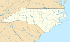
Stanleyville, North Carolina facts for kids
Quick facts for kids
Stanleyville, North Carolina
|
|
|---|---|
| Country | United States |
| State | North Carolina |
| County | Forsyth |
| Elevation | 942 ft (287 m) |
| Time zone | UTC-5 (Eastern (EST)) |
| • Summer (DST) | UTC-4 (EDT) |
| ZIP codes |
27105
|
| GNIS feature ID | 995415 |
Stanleyville is a small place in Forsyth County, North Carolina, United States. It's not a city or town with its own government. Instead, it's an unincorporated community, which means it's part of a larger county area.
Stanleyville is located between the bigger city of Winston-Salem and the community of Rural Hall. Many parts of Stanleyville have become part of Winston-Salem over time.
You can find Stanleyville along North Carolina Highway 66 (NC 66). It's also close to where NC 74 meets U.S. Route 52 (US 52). This makes it easy to get around the area.
This community has a history of farming. Recently, it has also seen more businesses and shops opening up. Stanleyville does not have its own post office. So, all mail for Stanleyville goes through the post office in nearby Rural Hall.
Contents
Exploring Stanleyville's Location
Stanleyville is found in the central part of North Carolina. It is part of Forsyth County, which is known for its mix of urban and rural areas.
How Stanleyville Connects to Other Places
The community sits right between two important places:
- Winston-Salem: This is a larger city to the south. Many people from Stanleyville might work or shop here.
- Rural Hall: This is another community located to the north.
Major Roads in Stanleyville
Stanleyville is easy to reach because of its location near main roads.
- North Carolina Highway 66 (NC 66): This highway runs right through the community.
- Interstate 74 (NC 74) and U.S. Route 52 (US 52): These are bigger highways that cross near Stanleyville. They help people travel to other cities and states.
Community Life and Growth
Stanleyville has changed over the years. It has grown from mainly farms to a place with more businesses.
Farming in Stanleyville
For a long time, farming was a big part of life here. The land was used for growing crops and raising animals. This tradition is still important to some residents.
New Businesses and Development
Recently, Stanleyville has seen new buildings and shops. This is called "commercial expansion." It means more places to work and shop are becoming available in the area. This growth helps the community develop.
See also
 In Spanish: Stanleyville (Carolina del Norte) para niños
 | Janet Taylor Pickett |
 | Synthia Saint James |
 | Howardena Pindell |
 | Faith Ringgold |


