
Stara Zagora Province facts for kids
Quick facts for kids
Stara Zagora Province
Област Стара Загора
|
|
|---|---|

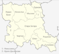
Location of Stara Zagora Province in Bulgaria
|
|
| Country | Bulgaria |
| Capital | Stara Zagora |
| Municipalities | 11 |
| Area | |
| • Total | 5,151.1 km2 (1,988.9 sq mi) |
| Population
(February 2011)
|
|
| • Total | 333,265 |
| • Density | 64.6978/km2 (167.5666/sq mi) |
| Time zone | UTC+2 (EET) |
| • Summer (DST) | UTC+3 (EEST) |
| License plate | CT |
| Website | sz.government.bg |
Stara Zagora is a province in the country of Bulgaria. It is like a large region or state within Bulgaria. The main city and capital of this province is also called Stara Zagora.
This province is located in the central part of Bulgaria. It covers an area of about 5,151 square kilometers. That's a bit larger than the country of Luxembourg! As of 2011, around 333,265 people lived in Stara Zagora Province.
Contents
What Are the Municipalities of Stara Zagora?
Stara Zagora Province is divided into 11 smaller areas called municipalities. Each municipality has its own main town or village. These smaller areas help manage local services and communities.
List of Municipalities and Their Main Towns
The table below shows the name of each municipality. It also lists its main town or village. You can see how many people lived in each area in December 2009.
| Municipality | Population (2009) | Main Town/Village | Town Population (2009) |
|---|---|---|---|
| Bratya Daskalovi | 9,724 | Bratya Daskalovi | 750 |
| Chirpan | 23,470 | Chirpan | 16,355 |
| Gurkovo | 5,273 | Gurkovo | 2,917 |
| Galabovo | 14,269 | Galabovo | 8,404 |
| Kazanlak | 76,447 | Kazanlak | 49,506 |
| Maglizh | 12,267 | Maglizh | 3,426 |
| Nikolaevo | 4,840 | Nikolaevo | 2,872 |
| Opan | 3,501 | Opan | 466 |
| Pavel Banya | 14,703 | Pavel Banya | 2,918 |
| Radnevo | 21,959 | Radnevo | 13,384 |
| Stara Zagora | 164,472 | Stara Zagora | 140,456 |
Images for kids
-
Map of Stara Zagora Province

See also
 Learn more about Stara Zagora Province in Spanish: Provincia de Stara Zagora para niños
